 Larger
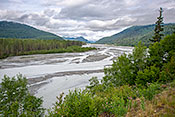
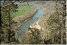
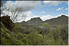
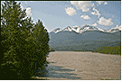
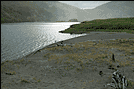
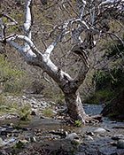
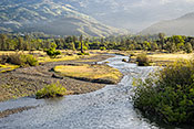
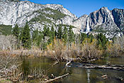
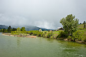
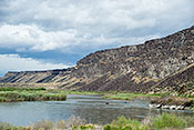
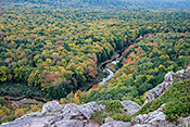
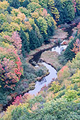
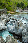
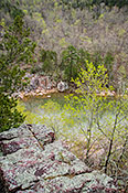
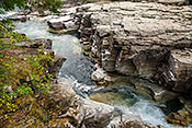
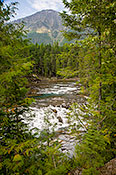
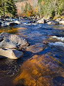
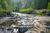
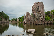
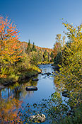
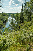
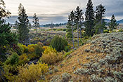
 #5147 Polychrome Mountains and Braided Stream (Jul 10, 2009), Denali National Park -- Polychrome Mountains, Healy, AK, 3
 Larger
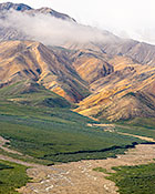
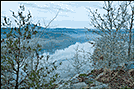
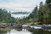
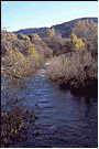
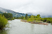
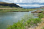
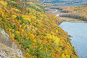
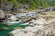
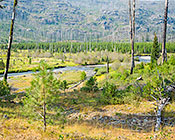
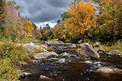
 #5135 Savage River, Tundra, and Smoky Sky (Jul 06, 2009), Denali National Park -- Savage River Area, Healy, AK, 3
 Larger
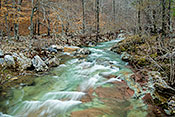
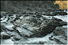
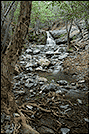
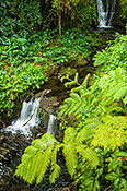
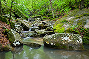
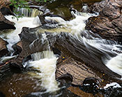
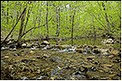
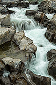
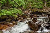
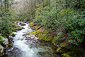
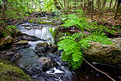
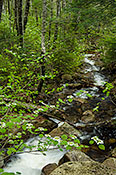
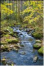
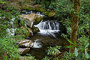
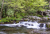
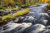
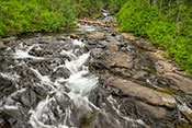
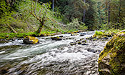
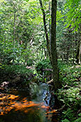
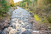
 #4942 Lunch Creek Cascade (Jun 12, 2009), Settlers Cove State Recreation Area, Ketchikan, AK, 3
 Larger
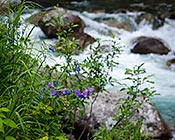
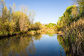
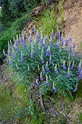
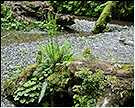
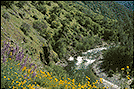
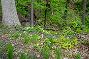
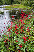
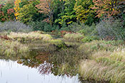
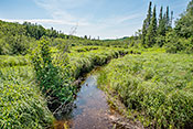
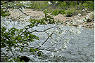
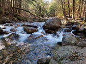
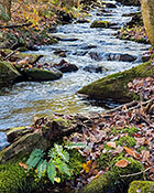
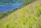
 #5029 Wildflowers on the Bank of the Little Susitna River (Jun 26, 2009), Hatcher Pass, Palmer, AK, 3
 Larger
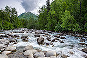
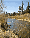
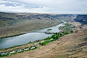
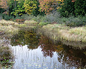
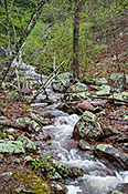
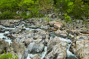
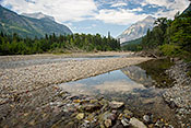
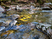
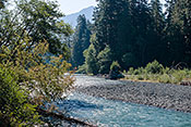
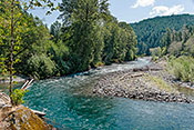
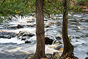
 #5028 Little Susitna River (Jun 26, 2009), Hatcher Pass, Palmer, AK, 3
 Larger
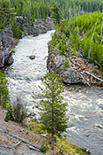
 #5100 Exit Glacier Reflected in the Resurrection River (Jul 01, 2009), Kenai Fjords National Park -- Exit Glacier, Seward, AK, 3
 Larger
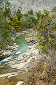
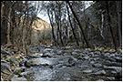
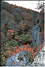
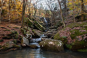
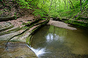
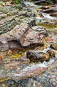
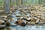
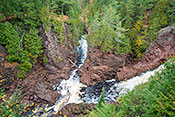
 #4072 Looking Down on Falling Water Creek (Mar 21, 2006), Ozark National Forest -- Falling Water Creek, Ben Hur, AR, 3
 Larger
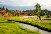
 #3960 Headlands in Sunset Light (Mar 27, 2006), Calico Rock, Calico Rock, AR, 3
 Larger
 #3964 The White River at Dawn (Mar 31, 2006), Calico Rock, Calico Rock, AR, 2
 Larger
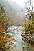
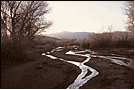
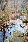
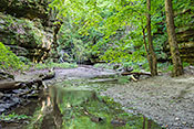
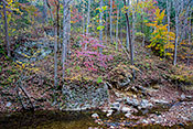
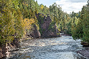
 #3915 Crooked Creek After a Heavy Rain (Mar 21, 2006), Ouachita National Forest Little Missouri River, Langley, AR, 4
 Larger
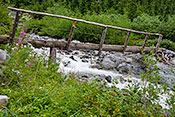
 #4326 Blaylock Creek Ford (Mar 29, 2007), Ouachita NF, Albert Pike Winding Stairs Trail, Langley, AR, 2
 Larger
 #4309 Dogwood Overhanging Blaylock Creek (Mar 28, 2007), Ouachita National Forest Caney Creek Wilderness, Langley, AR, 2
 Larger
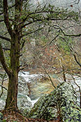
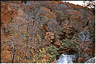
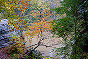
 #4360 Spring Snow Shower on the Little Missouri (Mar 23, 2006), Ouachita National Forest Little Missouri River, Langley, AR, 4
 Larger
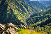
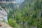
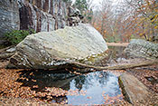
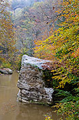
 #3913 Looking Across the Little Missouri River Gorge (Mar 20, 2006), Ouachita National Forest Little Missouri River, Langley, AR, 4
 Larger
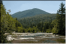
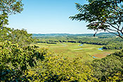
 #3937 Buffalo River from the Tyler Bend Overlook (Mar 01, 2006), Buffalo National River -- Tyler Bend, St. Joe, AR, 3
 Larger
 #4304 Cossatot River at Dusk (Mar 27, 2007), Cossatot River State Park Natural Area, Wickes, AR, 4
 Larger
 #4306 Cossatot River Shore (Mar 28, 2007), Cossatot River State Park Natural Area, Wickes, AR, 4
 Larger
 #4307 Sandstone in the River's Path (Mar 28, 2007), Cossatot River State Park Natural Area, Wickes, AR, 2
 Larger
 #3905 Cossatot River Falls Panorama (Mar 14, 2006), Cossatot River State Park Natural Area, Wickes, AR, 2
 Larger
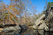
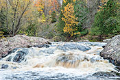
 #3899 Cossatot River Above the Falls (Mar 14, 2006), Cossatot River State Park Natural Area, Wickes, AR, 2
 Larger
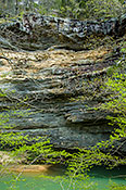
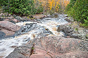
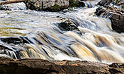
 #3904 Cossatot River Falls Detail (Mar 14, 2006), Cossatot River State Park Natural Area, Wickes, AR, 2
 Larger
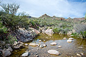
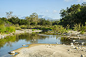
 #5227 Stream Flowing in the Desert (Feb 24, 2010), Tonto NF Superstition Wilderness Area, Apache Junction, AZ, 4
 Larger
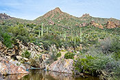
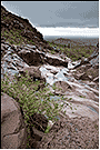
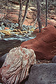
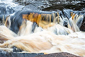
 #5228 Miniature Waterfall over Colorful Volcanic Rocks (Feb 24, 2010), Tonto NF Superstition Wilderness Area, Apache Junction, AZ, 4
 Larger
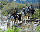
 #5229 Horses and Riders Crossing a Desert Stream (Feb 24, 2010), Tonto NF Superstition Wilderness Area, Apache Junction, AZ, 2
 Larger
 #4653 Verde River in Morning Light (Apr 02, 2009), Dead Horse Ranch State Park, Cottonwood, AZ, 3
 Larger
 #5215 Slick Rock in the Water Course (Feb 21, 2010), Tonto NF Hieroglyphics Canyon Trail, Gold Canyon, AZ, 2
 Larger
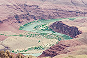
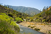
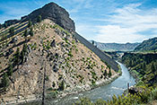
 #1894 River Bend from Lipan Point (Apr 13, 2012), Grand Canyon South Rim AZ 64 Area, Grand Canyon, AZ, 4
 Larger
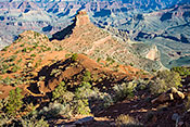
 #1882 Descending the Kaibob 8 -- Cedar Ridge (Apr 07, 2009), Grand Canyon South Rim AZ 64 Area, Grand Canyon, AZ, 4
 Larger
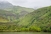
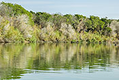
 #3402 Salt River Valley in a Wet Year (Feb 22, 2005), Tonto NF Salt River Riparian Area, Mesa, AZ, 2
 Larger
 #3508 Stream and Hillside near De La Ossa Well (Mar 21, 2005), Kofa National Wildlife Refuge, Quartzsite, AZ, 2
#4668 Oak Creek Canyon in Morning Light (Apr 04, 2009), Coconino National Forest -- Oak Creek Canyon, Sedona, AZ, 2
 Larger
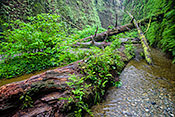
 #2778 Variety of Rock Types (Feb 20, 2003), Coconino National Forest -- Oak Creek Canyon, Sedona, AZ, 3
 Larger
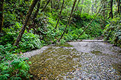
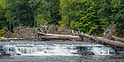
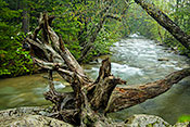
 #2779 Logs Showing Flood Consequence (Feb 20, 2003), Coconino National Forest -- Oak Creek Canyon, Sedona, AZ, 2
#2777 Along Oak Creek (Feb 20, 2003), Coconino National Forest -- Oak Creek Canyon, Sedona, AZ, 2
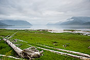
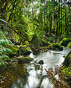
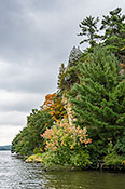
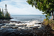
#4924 Creek Flowing Into the Fiord (Jun 09, 2009), Khutzeymateen Grizzly Bear Refuge, Prince Rupert, BC, 3
 Larger
 #4909 Skeena River Swollen with Snow Melt (Jun 07, 2009), The Skeena River Valley, Terrace, BC, 2
 Larger
 #4910 Skeen River Bordered by Sedge (Jun 08, 2009), The Skeena River Valley, Terrace, BC, 3
 Larger
 #2179 Threaded San Felipe Creek at Sunset (Feb 01, 2003), Anza-Borrego Desert, Borrego Springs, CA, 2
 Larger
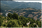
 #3134 Mattole River and Road (Jun 09, 2004), King's Range Mattole River Road and Beach, Ft. Bragg, CA, 2
 Larger
 #3133 Mattole River from Mattole Beach (Jun 10, 2004), King's Range Mattole River Road and Beach, Ft. Bragg, CA, 2
 Larger
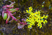
 #2685 Broadleaf Stonecrop Specimen (Apr 21, 2009), Stanislaus National Forest -- Lumsden (1N10) Rd, Groveland, CA, 4
 Larger
 #4716 A Spring Morning in the Tuolumne River Valley (Apr 21, 2009), Stanislaus National Forest -- Lumsden (1N10) Rd, Groveland, CA, 4
 Larger
 #4717 Dawn on the Tuolumne River (Apr 21, 2009), Stanislaus National Forest -- Lumsden (1N10) Rd, Groveland, CA, 4
 Larger
 #1971 Silver Bush Lupine on Canyon Side (Apr 21, 2009), Stanislaus National Forest -- Lumsden (1N10) Rd, Groveland, CA, 4
 Larger
 #4682 South Fork of Kern River (Apr 16, 2009), Sequoia National Forest -- Southern Sierras, Kernville, CA, 2
 Larger
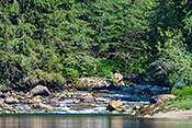
 #4686 Kern River at Delonegha Day Area (Apr 17, 2009), Sequoia National Forest -- Kern River Canyon, Lake Isabella, CA, 4
 Larger
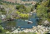
 #4687 Sycamores along the Kern River (Apr 17, 2009), Sequoia National Forest -- Kern River Canyon, Lake Isabella, CA, 3
 Larger
 #3056 Rush Creek in Early Spring (Apr 19, 2004), June Lake Loop, Lee Vining, CA, 2
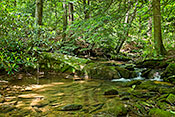
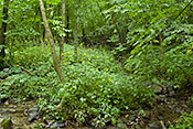
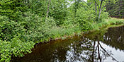
#2705 Harding Canyon Creek Flowing in Woods (Mar 05, 2003), Cleveland National Forest Harding Canyon, Modjeska, CA, 2
#2704 Harding Canyon Creek and Sycamore (Mar 13, 2023), Cleveland National Forest Harding Canyon, Modjeska, CA, 3
 Larger
 #2654 Big Sur River with Fall Color (Dec 23, 2002), California Big Sur Coast, Monterey, CA, 2
 Larger
 #3828 Rose Valley Creek (Jan 08, 2006), Rose Valley (Las Padres National Forest), Ojai, CA, 2
 Larger
 #4822 Log Centerpiece (May 19, 2009), Prairie Creek Redwoods Fern Canyon, Orick, CA, 2
 Larger
 #4818 Log Garden in Canyon Bottom Stream (May 14, 2009), Prairie Creek Redwoods Fern Canyon, Orick, CA, 4
 Larger
 #4820 Canyon Entrance (May 19, 2009), Prairie Creek Redwoods Fern Canyon, Orick, CA, 3
 Larger
 #4772 Creeks with Storm Runoff (May 09, 2009), Mendocino National Forest -- Lake Pillsbury, Potter Valley, CA, 3
 Larger
 #4773 Birds Over Stream (May 09, 2009), Mendocino National Forest -- Lake Pillsbury, Potter Valley, CA, 3
 Larger
 #3558 Sycamore in Bell Canyon (Apr 08, 2005), Caspers Wilderness Park, San Juan Capistrano, CA, 2
#2238 Bell Canyon Creek with Saddleback in Background (Apr 08, 2005), Caspers Wilderness Park, San Juan Capistrano, CA, 4
 Larger
 #2809 Poppies, Lupine, Trail and South Fork of Merced (Mar 31, 2003), Hite Cove Trail, Yosemite, CA, 2
 Larger
 #4720 Rafting the Merced (Apr 21, 2009), Hite Cove Trail, Yosemite, CA, 2
 Larger
 #2475 Merced River and Yosemite Falls from Bridge (Mar 23, 2002), Yosemite National Park, Yosemite Village, CA, 2
 Larger
 #2817 Redbuds along the Merced (Mar 31, 2003), Yosemite National Park, Yosemite Village, CA, 2
 Larger
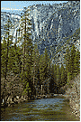
 #4710 Merced River and Upper Yosemite Falls (Apr 20, 2009), Yosemite National Park, Yosemite Village, CA, 4
 Larger
 #4526 Tree Ferns Overhanging Stream (Jan 15, 2008), Akaka Falls State Park, Honomu, HI, 3
 Larger
 #4416 Stream through the Palm Jungle (Jan 15, 2008), Hawaii Tropical Botanical Garden, Papaikou, HI, 3
 Larger
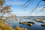
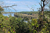
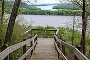
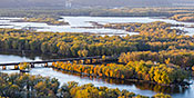
 #5769 Mississippi River Islands (Oct 20, 2010), Mt. Hosmer City Park, Lansing, IA, 3
 Larger
 #5768 Lansing Marina on the Mississippi River (Oct 20, 2010), Mt. Hosmer City Park, Lansing, IA, 2
 Larger
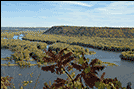
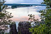
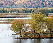
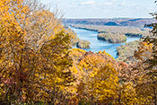
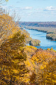
 #3787 The Confluence of the Wisconsin and Mississippi Rivers (Oct 19, 2005), Pikes Peak State Park, McGregor, IA, 3
 Larger
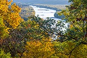
 #3788 Speedboat on the Mississippi River in Fall (Oct 19, 2005), Pikes Peak State Park, McGregor, IA, 2
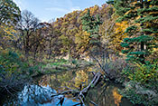
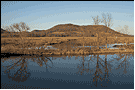
#3791 Maples and Prairie Grass at Mississippi River Overlook (Oct 19, 2005), Pikes Peak State Park, McGregor, IA, 3
 Larger
 #3792 Barge Traffic on the Mississippi River in Fall (Oct 19, 2005), Pikes Peak State Park, McGregor, IA, 3
 Larger
 #3801 The Industrial Upper Mississippi River (Oct 20, 2005), Pikes Peak State Park, McGregor, IA, 2
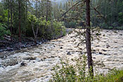
#6091 Shooting the Payette River Rapids #1 (May 05, 2012), Payette River Along Banks Lowman Highway, Banks, ID, 3
 Larger
 #6094 Ranchland Along the South Fork of the Payette River (May 05, 2012), Payette River Along Banks Lowman Highway, Banks, ID, 3
 Larger
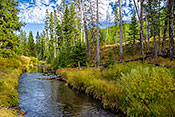
 #6093 South Fork of the Payette River (May 05, 2012), Payette River Along Banks Lowman Highway, Banks, ID, 3
 Larger
 #2060 Grimes Pass Overlook (May 05, 2012), Payette River Along Banks Lowman Highway, Banks, ID, 3
 Larger
 #437 Flatiron Mountain Beside the Boise River (Jul 05, 2014), Blacks Creek Road, Boise, ID, 3
 Larger
 #6061 Idaho Power Swan Falls Dam (May 03, 2012), Snake River Birds of Prey Conservation Area, Kuna, ID, 3
 Larger
 #6062 Snake River Below the Swan Falls Dam (May 03, 2012), Snake River Birds of Prey Conservation Area, Kuna, ID, 3
 Larger
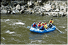
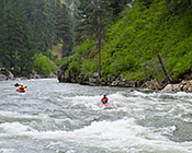
 #6063 Rafts on the Snake River Below Swan Falls Dam (May 03, 2012), Snake River Birds of Prey Conservation Area, Kuna, ID, 3
 Larger
 #2561 Grassy Creek in Fall (Oct 25, 2005), Devil's Kitchen Lake, Carbondale, IL, 3
 Larger
 #2619 Devil's Backbone and Pool on Bay Creek (Oct 31, 2010), Shawnee NF -- Bell Smith Springs, Eddyville, IL, 3
 Larger
 #2557 Lusk Creek from Overlook (Oct 29, 2003), Lusk Creek Canyon Nature Preserve, Eddyville, IL, 2
 Larger
 #2828 Lusk Creek and Hillside (Oct 29, 2003), Lusk Creek Canyon Nature Preserve, Eddyville, IL, 2
 Larger
 #4343 Lusk Creek Canyon Wall with Ice (Apr 07, 2007), Lusk Creek Canyon Nature Preserve, Eddyville, IL, 3
 Larger
 #926 Bay Creek with Sandstone Boulders (Nov 04, 2014), Shawnee NF -- Bell Smith Springs, Eddyville, IL, 3
 Larger
 #942 Devil's Backbone in Bay Creek (Nov 04, 2014), Shawnee NF -- Bell Smith Springs, Eddyville, IL, 3
 Larger
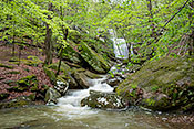
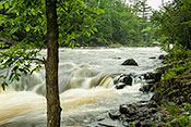
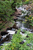
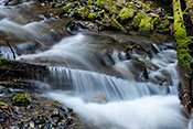
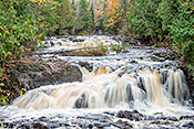
 #3996 Falls and Outflow After a Storm (Apr 28, 2014), Shawnee NF -- Burden Falls Wilderness, Harrisburg, IL, 3
 Larger
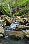
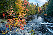
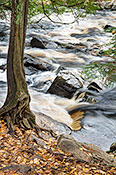
 #3990 Burden Creek with Falls in Background (Apr 16, 2011), Shawnee NF -- Burden Falls Wilderness, Harrisburg, IL, 4
 Larger
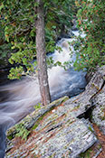
 #5747 Burden Falls Creek in Spring (Apr 24, 2010), Shawnee NF -- Burden Falls Wilderness, Harrisburg, IL, 4
 Larger
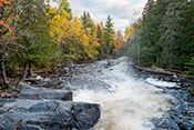
 #5723 Burden Falls Creek in Autumn (Nov 06, 2018), Shawnee NF -- Burden Falls Wilderness, Harrisburg, IL, 3
 Larger
 #5414 Ravine Edge (May 17, 2017), Lake Bluff Ravine Park, Lake Bluff, IL, 2
 Larger
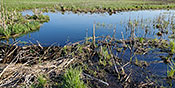
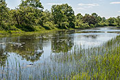
 #7285 Beaver Dam and Pond (May 01, 2021), Lake in the Hills Fen, Lake in the Hills, IL, 2
 Larger
 #7418 Rock River from Bluffside (Oct 15, 2021), Castle Rock State Park, Oregon, IL, 3
 Larger
 #725 Redbud Blooming in Illinois Canyon (May 05, 2015), Starved Rock State Park, Ottawa, IL, 3
 Larger
 #1303 Bluff Along the Illinois River in Early Autumn (Sep 28, 2011), Starved Rock State Park, Ottawa, IL, 2
 Larger
 #4618 Barge Traffic on the Icy Illinois River (Jan 31, 2009), Starved Rock State Park, Ottawa, IL, 2
 Larger
 #4609 Illinois River Valley in Winter (Mar 06, 2015), Starved Rock State Park, Ottawa, IL, 3
 Larger
 #5358 Lower LaSalle Canyon in Fall (Nov 01, 2016), Starved Rock State Park, Ottawa, IL, 3
 Larger
 #6592 LaSalle Canyon Outflow (May 14, 2014), Starved Rock State Park, Ottawa, IL, 3
 Larger
 #5419 Kaskaskia Canyon Stream (May 18, 2017), Starved Rock State Park, Ottawa, IL, 3
 Larger
 #5360 Looking Up the Illinois River from Starved Rock in Fall (Nov 01, 2016), Starved Rock State Park, Ottawa, IL, 3
 Larger
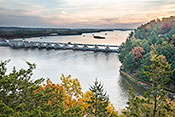
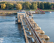
 #5368 Illinois River Lock and Dam (Nov 01, 2016), Starved Rock State Park, Ottawa, IL, 3
 Larger
 #5367 Bluff Along the Illinois River in Autumn (Nov 01, 2016), Starved Rock State Park, Ottawa, IL, 3
 Larger
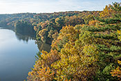
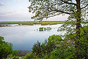
 #1342 Mississippi River at Dusk (Aug 29, 2007), Mississippi Palisades S.P., Savanna, IL, 3
 Larger
 #1343 Mississippi River from Palisades Sentinel Rock Trail (Oct 28, 2006), Mississippi Palisades S.P., Savanna, IL, 3
 Larger
 #2500 View from Sentinel Point Bluff Top in Fall (Oct 21, 2003), Mississippi Palisades S.P., Savanna, IL, 2
 Larger
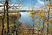
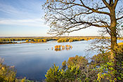
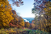
 #2347 Mississippi Overlook from Oak Point in Spring (Apr 22, 2010), Mississippi Palisades S.P., Savanna, IL, 3
 Larger
 #1341 Sentinel Rock and the Mississippi River at Dusk (Aug 29, 2007), Mississippi Palisades S.P., Savanna, IL, 4
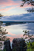 Larger
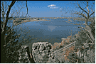
 #3079 Downstream View of Mississippi from Sentinel Rock Overlook (Apr 28, 2004), Mississippi Palisades S.P., Savanna, IL, 2
#3078 Upstream View of Mississippi from Sentinel Rock Overlook (Apr 28, 2004), Mississippi Palisades S.P., Savanna, IL, 2
#2357 Mississippi Overlook from Oak Point in Autumn (Oct 21, 2010), Mississippi Palisades S.P., Savanna, IL, 3
 Larger
 #7685 Sentinel Rock Overlook in July (Jul 21, 2023), Mississippi Palisades S.P., Savanna, IL, 3
 Larger
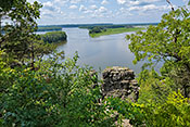
 #6580 Looking Down the Mississippi from the Oak Point Deck (May 14, 2014), Mississippi Palisades S.P., Savanna, IL, 3
 Larger
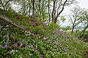
 #2349 Bluff Side with Shootingstars Overlooking the Mississippi (May 09, 2018), Mississippi Palisades S.P., Savanna, IL, 3
 Larger
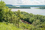
 #3070 Mississippi River Transportation Corridor (Jul 28, 2016), Mississippi Palisades S.P., Savanna, IL, 3
 Larger
 #2482 Indian Grass Along the Shore of the Dead River (Sep 10, 2003), Illinois Beach State Park, Zion, IL, 2
#2358 Dead River Overview with Sedge Meadows and Oaks (Jun 02, 2016), Illinois Beach State Park, Zion, IL, 3
 Larger
 #6569 Sugar Creek from Sunset Point at Sunrise (May 08, 2014), Turkey Run State Park, Marshall, IN, 3
 Larger
 #5862 Lacy Fall Foliage Along the Middle Fork of the Red River (Oct 18, 2011), Natural Bridge State Park, Slade, KY, 3
 Larger
 #5835 Boulder on the Red River Shore (Oct 20, 2011), Red River Gorge, Stanton, KY, 3
 Larger
 #5837 Foliage Along the Red River Shore (Oct 20, 2011), Red River Gorge, Stanton, KY, 3
 Larger
 #3756 Trout Brook Crossing (Sep 07, 2005), Baxter State Park, Millinocket, ME, 2
#3758 Ledge Falls (Sep 07, 2005), Baxter State Park, Millinocket, ME, 2
 Larger
 #3693 A Mass of Cardinal Flowers Along a Creek Bank (Aug 29, 2005), Along Maine Route 9, Washington County, ME, 3
 Larger
 #5567 Montreal River Mouth (Oct 14, 2017), Montreal River Falls, Copper Harbor, MI, 2
 Larger
 #1839 Lower Silver River Shore (Oct 09, 2015), Baraga County, L'Anse, MI, 3
 Larger
 #1980 6. Descending to Sturgeon Falls -- Upstream Cascade (Oct 08, 2015), Baraga County, L'Anse, MI, 3
 Larger
 #1817 Lower Silver River in Autumn (Oct 09, 2015), Baraga County, L'Anse, MI, 3
 Larger
 #5558 White-Cedar on Bare Rock (Oct 11, 2017), Baraga County, L'Anse, MI, 3
 Larger
 #5556 Lower Silver River High Water (Oct 11, 2017), Baraga County, L'Anse, MI, 3
 Larger
 #959 First Pier along Menominee River (Jun 14, 2005), Piers Gorge, Norway, MI, 3
 Larger
 #3208 Lake of the Clouds Headlands and Stream Valley (Oct 06, 2015), Porcupine Mountains - Lake of the Clouds, Ontonagon, MI, 3
 Larger
 #1953 Grass, Sedge and Tree Reflections (Oct 06, 2015), Porcupine Mountains - Big Carp River, Ontonagon, MI, 3
 Larger
 #1924 River Potholes Close-up (Oct 05, 2015), Porcupine Mountains - Presque Isle, Ontonagon, MI, 3
 Larger
 #1950 Lilypads and Tree Reflections (Oct 06, 2015), Porcupine Mountains - Big Carp River, Ontonagon, MI, 3
 Larger
 #1945 Carp River Portrait (Oct 06, 2015), Porcupine Mountains - Lake of the Clouds, Ontonagon, MI, 3
 Larger
 #5578 Lake of the Clouds and Carp River Inlet (Oct 16, 2017), Porcupine Mountains - Escarpment Trail, Ontonagon, MI, 3
 Larger
 #1927 Presque Isle Pool (Oct 05, 2015), Porcupine Mountains - Presque Isle, Ontonagon, MI, 3
 Larger
 #5579 Carp River Overflook (Oct 17, 2017), Porcupine Mountains - Escarpment Trail, Ontonagon, MI, 3
 Larger
 #5506 Grassy Meadow along the Little Carp River (Jul 25, 2017), Porcupine Mountains - Beaver Creek Trail, Ontonagon, MI, 3
 Larger
 #1938 Huge Trees Washed into the Presque Isle River (Oct 05, 2015), Porcupine Mountains - Presque Isle, Ontonagon, MI, 2
 Larger
 #1922 Potholes in the Lower Presque Isle River (Oct 05, 2015), Porcupine Mountains - Presque Isle, Ontonagon, MI, 3
 Larger
 #1658 Pool and Downstream Cascade (Apr 11, 2011), Johnson's Shut-Ins State Park, Graniteville, MO, 4
 Larger
 #3661 From One Rapids to the Next (Apr 29, 2005), Johnson's Shut-Ins State Park, Graniteville, MO, 4
 Larger
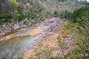
 #3652 A Rocky Ford Along the Ozark Trail (Apr 28, 2005), Johnson's Shut-Ins State Park, Graniteville, MO, 2
 Larger
 #3662 River Entering the Shut-In (Apr 29, 2005), Johnson's Shut-Ins State Park, Graniteville, MO, 2
#1652 Ravine Run-Off (Apr 11, 2011), Johnson's Shut-Ins State Park, Graniteville, MO, 4
 Larger
 #3663 Dogwood on the River Shore (Apr 29, 2005), Johnson's Shut-Ins State Park, Graniteville, MO, 2
 Larger
 #1651 Lichen on Rhyolite with River Background (Apr 11, 2011), Johnson's Shut-Ins State Park, Graniteville, MO, 4
 Larger
 #3660 River Flowing through the Shut-In (Apr 29, 2005), Johnson's Shut-Ins State Park, Graniteville, MO, 4
 Larger
 #3659 Shut-In Overlook (Apr 29, 2005), Johnson's Shut-Ins State Park, Graniteville, MO, 4
 Larger
 #6428 Ascending to Iceberg Lake 2. Ptarmigan Creek (Sep 09, 2013), Glacier National Park Iceberg Lake Trail, Babb, MT, 4
 Larger
 #6432 Ascending to Iceberg Lake 5. Iceberg Lake Outflow (Sep 09, 2013), Glacier National Park Iceberg Lake Trail, Babb, MT, 4
 Larger
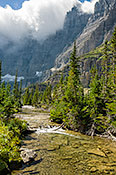
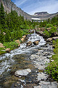
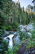
 #5176 Creek Flowing Through a Burned Forest (Jul 18, 2009), Glacier National Park Going to the Sun, West Glacier, MT, 4
 Larger
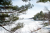
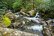
 #5181 Lunch Creek and Snow Field (Jul 18, 2009), Glacier National Park Going to the Sun, West Glacier, MT, 4
 Larger
 #6398 Burned Forest Along the North Fork Flathead River (Sep 05, 2013), Glacier National Park North Fork Roads, West Glacier, MT, 4
 Larger
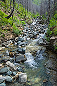
 #6402 Ascending to Avalanche Lake 01. Lower Avalanche Creek (Sep 06, 2013), Glacier National Park Avalanche Creek Trail, West Glacier, MT, 4
 Larger
 #6403 Ascending to Avalanche Lake 02. Avalance Creek Gorge (Sep 06, 2013), Glacier National Park Avalanche Creek Trail, West Glacier, MT, 4
 Larger
 #6407 Ascending to Avalanche Lake 06. Creek and Trail Diverge (Sep 06, 2013), Glacier National Park Avalanche Creek Trail, West Glacier, MT, 4
 Larger
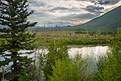
 #6400 Glacier Peak Reflected in McDonald Creek (Sep 05, 2013), Glacier National Park Lake McDonald Lake, West Glacier, MT, 4
 Larger
 #6401 McDonald Creek Cascade (Sep 05, 2013), Glacier National Park Lake McDonald Lake, West Glacier, MT, 4
 Larger
 #6884 High Falls and Outflow Stream (Apr 17, 2015), Dupont State Forest, Brevard, NC, 3
 Larger
 #6865 Courthouse Creek Detail (Apr 16, 2015), Pisgah National Forest Courthouse Falls, Brevard, NC, 3
 Larger
 #6876 Little River Cascade (Apr 17, 2015), Dupont State Forest, Brevard, NC, 3
 Larger
 #6864 Courthouse Creek Along FR 140 (Apr 16, 2015), Pisgah National Forest Courthouse Falls, Brevard, NC, 3
 Larger
 #7426 Lower Falls of the Swift River (Oct 29, 2021), Kancamagus Highway, Lincoln, NH, 3
 Larger
 #7421 Ascending to Sabbaday Falls 2 (Oct 29, 2021), Kancamagus Highway, Lincoln, NH, 3
 Larger
 #7420 Ascending to Sabbaday Falls 1 (Oct 29, 2021), Kancamagus Highway, Lincoln, NH, 3
 Larger
 #5795 Brook in Deep Woods (Jun 11, 2011), Native Plant Discovery, Orford, NH, 3
 Larger
 #7718 Indian Pond Brook Cascade (Oct 27, 2023), Native Plant Discovery, Orford, NH, 3
 Larger
 #4064 The Pemigewasset River Framed by Tip Up (May 19, 2006), White Mountains of New Hampshire, Sugar Hill, NH, 4
 Larger
 #4065 A Right Angle Turn on the Pemigewasset River (May 19, 2006), White Mountains of New Hampshire, Sugar Hill, NH, 3
 Larger
 #4063 Hobblebush over Stream -- Arethusa Falls Trail (May 20, 2006), White Mountains of New Hampshire, Sugar Hill, NH, 4
 Larger
 #2525 Swift Water Covered Bridge in Fall (Oct 14, 2003), White Mountains of New Hampshire, Sugar Hill, NH, 2
#795 Stream with Water Lilies (Jun 20, 1999), Adirondack Park, Lake Clear, NY, 2
#4294 Beech Creek in Early Spring (Mar 24, 2007), Ouachita NF, Beech Creek National Botanical Area, Smithville, OK, 3
 Larger
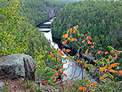
 #3189 Sumac on the Rim of Barron Canyon (Sep 28, 2004), Algonquin Provincial Park, Achray Area, Pembroke, ON, 3
 Larger
 #6307 Wind Surfer Panorama (Aug 12, 2013), Columbia River Gorge National Scenic Area, Hood River, OR, 3
 Larger
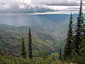
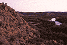
 #3176 A Stormy Day at Hat Point Overlook (Jun 18, 2004), Hells Canyon NRA, Joseph, OR, 3
 Larger
 #6382 Imnaha River at Dusk (Aug 26, 2013), Hells Canyon NRA, Joseph, OR, 3
 Larger
 #6386 Imnaha River Salmon Spawning Gravel Beds (Aug 27, 2013), Hells Canyon NRA, Joseph, OR, 3
 Larger
 #6380 Colorful Boulders in the Imnaha River (Aug 26, 2013), Hells Canyon NRA, Joseph, OR, 3
 Larger
 #6192 Idaho Shore from Brownlee Oxbow Highway (May 04, 2012), Hells Canyon NRA, Joseph, OR, 3
 Larger
 #5819 Two Rock Run Pool (Jun 19, 2011), Bear Creek Forest, Orviston, PA, 3
 Larger
 #6294 Palisades Along the Split Rock Creek (Aug 04, 2013), Palisades State Park, Garretson, SD, 3
 Larger
 #5865 Cosby Creek Cascade (Oct 25, 2011), Great Smoky Mountains (Cosby Camp), Cosby, TN, 2
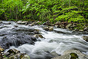
 Larger
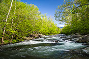
 #1088 Cascades along the Middle Prong of the Little River (Apr 27, 2010), Great Smoky Mountains (Middle Prong), Gatlinburg, TN, 3
 Larger
 #1056 Woods and Water -- Little Pigeon River (May 01, 2010), Great Smoky Mountains (Ramsey Cascade Trail), Gatlinburg, TN, 3
 Larger
 #1097 Little Pigeon River along the Greenbrier Road (Apr 28, 2010), Great Smoky Mountains (Ramsey Cascade Trail), Gatlinburg, TN, 3
 Larger
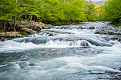
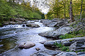
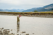
 #1070 Fly-fishing in the Smokies (Apr 26, 2001), Great Smoky Mountains (US 441 to Newfound Gap), Gatlinburg, TN, 2
#1128 Pool on the Little Pigeon River (May 01, 2010), Great Smoky Mountains (Ramsey Cascade Trail), Gatlinburg, TN, 3
 Larger
 #1100 Cascades along the Little Pigeon River (Apr 28, 2010), Great Smoky Mountains (Ramsey Cascade Trail), Gatlinburg, TN, 3
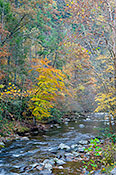
 Larger
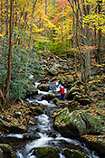
 #5874 Photographer in Middle Fork of the Little River (Oct 27, 2011), Great Smoky Mountains (Little River Rd; Cades C), Gatlinburg, TN, 3
 Larger
 #5872 Striped Maple Foliage Beside Fighting Creek Cascade (Oct 27, 2011), Great Smoky Mountains (Little River Rd; Cades C), Gatlinburg, TN, 3
 Larger
 #5873 Hillside Along Fighting Creek (Oct 27, 2011), Great Smoky Mountains (Little River Rd; Cades C), Gatlinburg, TN, 3
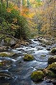
 Larger
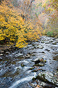
 #5875 Fall Colors along the Middle Fork of the Little River (Oct 27, 2011), Great Smoky Mountains (Little River Rd; Cades C), Gatlinburg, TN, 3
 Larger
 #1091 Middle Prong with Flowering Dogwood (Apr 27, 2010), Great Smoky Mountains (Middle Prong), Gatlinburg, TN, 3
 Larger
 #1014 Little Pigeon River Shore in Morning Light (May 03, 2014), Great Smoky Mountains (Ramsey Cascade Trail), Gatlinburg, TN, 3
 Larger
 #1072 Little Pigeon River Cascade and Shoreline (May 04, 2014), Great Smoky Mountains (Ramsey Cascade Trail), Gatlinburg, TN, 3
 Larger
 #4193 Rio Grande from a Canoe (Feb 06, 2007), Santa Ana National Wildlife Refuge, Alamo, TX, 3
 Larger
 #2841 Hikers Enjoying the Sunset (Dec 26, 2003), Big Bend National Park Rio Grande Vlg Area, Alpine, TX, 2
 Larger
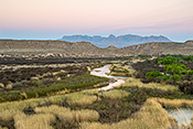
 #4221 Rio Grande and Chisos Mountains at Dawn (Mar 03, 2007), Big Bend National Park Rio Grande Vlg Area, Alpine, TX, 3
 Larger
 #2840 Sunset near Boquillas Crossing (Dec 26, 2003), Big Bend National Park Rio Grande Vlg Area, Alpine, TX, 2
 Larger
 #6504 Logan River Through the Logan Canyon (Sep 22, 2013), Logan Canyon, Logan, UT, 3
 Larger
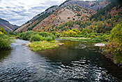
 #6026 Morning along the Virgin River (Apr 23, 2012), Zion NP, Springdale, UT, 3
 Larger
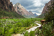
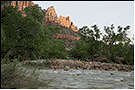
 #1832 Virgin River from Kayenta Trail with Stormy Sky (Apr 19, 2005), Zion NP, Springdale, UT, 4
 Larger
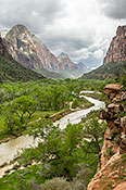
 #1833 Zion Canyon from the Kayenta Trail with Storm Brewing (Apr 19, 2005), Zion NP, Springdale, UT, 3
 Larger
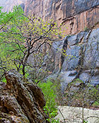
 #3621 A Rainy Day Along the Zion Canyon Riverwalk Trail (Apr 20, 2005), Zion NP, Springdale, UT, 3
 Larger
 #3620 The Virgin River at the Watchman Campgrounds (Apr 21, 2005), Zion NP, Springdale, UT, 2
 Larger
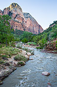
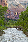
 #1823 Virgin River Running High as Seen from Lodge Footbridge (Apr 19, 2005), Zion NP, Springdale, UT, 3
 Larger
 #4395 Moose River along Victory Road (Oct 05, 2007), Victory Basin Wildlife Management Area, North Concord, VT, 4
 Larger
 #4396 Moose River along River Road (Oct 05, 2007), Victory Basin Wildlife Management Area, North Concord, VT, 4
 Larger
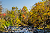
 #7065 Sunlit Fall Foliage along the Moose River (Oct 05, 2019), Victory Basin Wildlife Management Area, North Concord, VT, 3
 Larger
 #7066 Moose River in Autumn (Oct 05, 2019), Victory Basin Wildlife Management Area, North Concord, VT, 3
 Larger
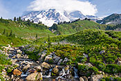
 #6323 Mt. Rainier from the Paradise Stream Crossing (Aug 14, 2013), Mt. Rainier National Park Paradise Area, Ashford, WA, 3
 Larger
 #6340 Paradise River Above the Narada Falls (Aug 14, 2013), Mt. Rainier National Park Stevens Canyon Road, Ashford, WA, 3
 Larger
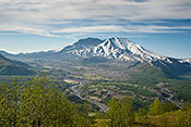
 #4853 Toutle River Cuts New Course (May 27, 2009), Mt. St. Helens National Volcanic Monument West, Castle Rock, WA, 3
 Larger
 #6795 Hoh River Sparkling in the Morning Sun (Jul 28, 2014), Olympic National Park -- Hoh River Trail, Forks, WA, 3
 Larger
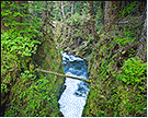
 #4862 Willaby Creek Gorge Wall (May 28, 2009), Olympic National Park -- Quinault, Hoquiam, WA, 4
 Larger
 #4892 Sol Duc River Gorge Below the Falls (Jun 01, 2009), Olympic National Park -- Sol Duc River Valley, Port Angeles, WA, 2
 Larger
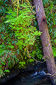
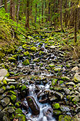
 #4895 Sol Duc Mountain Stream Tributary (Jun 01, 2009), Olympic National Park -- Sol Duc River Valley, Port Angeles, WA, 4
 Larger
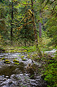
 #4893 Fallen Tree in the Sol Duc River (Jun 01, 2009), Olympic National Park -- Sol Duc River Valley, Port Angeles, WA, 4
 Larger
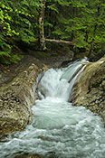
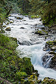
 #4890 Sol Duc River Cascade (Jun 01, 2009), Olympic National Park -- Sol Duc River Valley, Port Angeles, WA, 4
 Larger
 #4896 Moss Laden Forest by the Sol Duc River (Jun 01, 2009), Olympic National Park -- Sol Duc River Valley, Port Angeles, WA, 4
 Larger
 #4898 Sol Duc River Raceway (Jun 01, 2009), Olympic National Park -- Sol Duc River Valley, Port Angeles, WA, 4
 Larger
 #6783 Goblin's Gate on the Elwah River (Jul 26, 2014), Olympic National Park -- Humes Ranch Trail, Port Angeles, WA, 3
 Larger
 #6785 Bend on the Restored Elwah River (Jul 26, 2014), Olympic National Park -- Humes Ranch Trail, Port Angeles, WA, 3
 Larger
 #6806 Ascending to Summerland 2: Seasonal Stream (Jul 30, 2014), Mt. Rainier National Park Summerland Trail, White River Entrance, WA, 4
 Larger
 #6807 Ascending to Summerland 3: Frying Pan Creek Cascade (Jul 30, 2014), Mt. Rainier National Park Summerland Trail, White River Entrance, WA, 4
 Larger
 #6359 Log Footbridge over Fryingpan Creek (Aug 15, 2013), Mt. Rainier National Park Summerland Trail, White River Entrance, WA, 3
 Larger
 #3239 Buffalo River (Nov 12, 2004), Rieck's Lake and Buffalo River, Alma, WI, 2
 Larger
 #4372 Green-headed Coneflowers in the Glen (Aug 06, 2007), Parfrey's Glen SNA, Baraboo, WI, 2
 Larger
 #3776 Mississippi River Islands and Iowa Bluff Side (Oct 19, 2014), Dugway Road, Cassville, WI, 3
 Larger
 #856 Cedar Swamp Stream (Jun 15, 2005), Shadow (Boot) Lake, Florence, WI, 2
#2906 Lepage Creek Overlook in Spring (May 20, 2004), Spread Eagle Barrens SNA, Florence, WI, 2
#5479 Pine River Overlook (Jul 20, 2017), Spread Eagle Barrens SNA, Florence, WI, 2
 Larger
 #7004 Toy Lake Outflow Stream (Jul 21, 2019), Toy Lake Swamp SNA, Manitowish Waters, WI, 3
 Larger
 #5333 Tyler Fork Cascade (Oct 12, 2016), Copper Falls State Park, Mellen, WI, 3
 Larger
 #5331 White-Cedar on the Edge (Oct 12, 2016), Copper Falls State Park, Mellen, WI, 3
 Larger
 #5330 Bad River Cascade (Oct 13, 2016), Copper Falls State Park, Mellen, WI, 3
 Larger
 #5332 Twin Cedars on the Shore (Oct 12, 2016), Copper Falls State Park, Mellen, WI, 3
 Larger
 #5347 Red Granite Falls Looking Downstream (Oct 12, 2016), Copper Falls State Park, Mellen, WI, 3
 Larger
 #5345 Red Granite Falls of the Bad River Upper Cascade (Oct 12, 2016), Copper Falls State Park, Mellen, WI, 3
 Larger
 #5327 Tyler Fork Meets the Main Bad River Stream (Oct 12, 2016), Copper Falls State Park, Mellen, WI, 3
 Larger
 #5719 The Bad River through Devil's Gate (Oct 16, 2018), Copper Falls State Park, Mellen, WI, 3
 Larger
 #5718 Red Granite Falls Close Up (Oct 17, 2018), Copper Falls State Park, Mellen, WI, 3
 Larger
 #5346 Red Granite Falls Detail (Oct 12, 2016), Copper Falls State Park, Mellen, WI, 3
 Larger
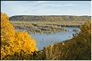
 #5763 Wisconsin River Fall Landscape (Oct 20, 2014), Wyalusing SP, Prairie Du Chien, WI, 3
 Larger
 #3782 Sunrise over the Wisconsin River (Oct 20, 2014), Wyalusing SP, Prairie Du Chien, WI, 4
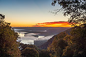
 Larger
 #3781 Ground Fog at Dawn Along the Wisconsin River (Oct 18, 2005), Wyalusing SP, Prairie Du Chien, WI, 3
 Larger
 #3786 Wisconsin River Panorama (Oct 18, 2010), Wyalusing SP, Prairie Du Chien, WI, 3
 Larger
 #3780 Full Moon Shining on Wisconsin River (Oct 17, 2005), Wyalusing SP, Prairie Du Chien, WI, 2
#5759 Fishing in the Mississippi Backwaters (Oct 17, 2010), Wyalusing SP, Prairie Du Chien, WI, 2
 Larger
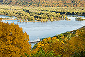
 #5762 Wisconsin River Fall Portrait (Oct 20, 2014), Wyalusing SP, Prairie Du Chien, WI, 4
 Larger
 #3785 Wisconsin River Valley with Fall Foliage (Oct 19, 2005), Wyalusing SP, Prairie Du Chien, WI, 4
 Larger
 #3784 Maple Trees in Fall Foliage on Wisconsin River Bluff (Oct 18, 2005), Wyalusing SP, Prairie Du Chien, WI, 2
 Larger
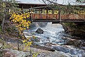
 #5720 Horton Bowstring Bridge and Amnicon Falls (Oct 15, 2018), Amnicon Falls State Park, Superior, WI, 3
 Larger
 #1963 Trempealeau Mountain from the River Trail (Aug 22, 2016), Perrot State Park, Trempealeau, WI, 2
 Larger
 #183 Late Summer Goat Prairie (Aug 22, 2016), Perrot State Park, Trempealeau, WI, 3
 Larger
 #1551 Trempealeau River from Brady's Bluff (Aug 22, 2016), Perrot State Park, Trempealeau, WI, 3
 Larger
 #2581 Bluff Creek Side in Late Summer (Aug 10, 2002), Bluff Creek Springs, Fens, and Oak Woods SNA, Whitewater, WI, 2
#7366 Flambeau River Shoreline (Jun 29, 2021), Doering Woods State Natural Area, Woodruff, WI, 2
 Larger
 #6446 Gibbon River Through the Forest (Sep 12, 2013), Yellowstone Canyon to Norris Road, Canyon Village, WY, 3
 Larger
 #6478 Phelps Lake Outflow (Sep 16, 2013), Grand Teton National Park Rockefeller Preserve, Jackson (Hole), WY, 3
 Larger
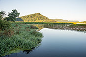
 #6306 Teton Range Reflected in the Snake River (Aug 07, 2013), Grand Teton National Park Along US 89 and 191, Jackson (Hole), WY, 3
 Larger
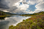
 #6484 Storm over the Teton Range from the Snake River Oxbow Bend (Sep 16, 2013), Grand Teton National Park Along US 89 and 191, Jackson (Hole), WY, 4
 Larger
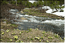
 #3163 Globeflowers Lining Stream (Jun 04, 2004), Medicine Bow National Forest Snowy Mountains, Laramie, WY, 2
 Larger
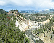
 #6181 Calcite Springs on the Yellowstone River (May 16, 2012), Yellowstone Grand Loop Mammoth to Tower, Mammoth, WY, 3
 Larger
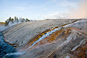
 #6148 Midway Geyser Basin Runoff into Fire Hole River (May 14, 2012), Yellowstone Grand Loop Madison to West Thumb, Mammoth, WY, 3
 Larger
 #6437 Blacktail Deer Creek Morning Light (Sep 13, 2013), Yellowstone Grand Loop Mammoth to Tower, Mammoth, WY, 3
 Larger
 #6142 Fire Hole River Cascades (May 17, 2012), Yellowstone Grand Loop Madison to West Thumb, Mammoth, WY, 3
 Larger
 #6298 The Belle Fourche River Runs Through the Park (Aug 06, 2013), Devils Tower National Monument, Sundance, WY, 2
 Larger
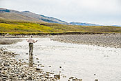
 #6440 Fly-Fishing in the Lamar River (Sep 13, 2013), Yellowstone Northeast Entrance (Lamar Valley), Tower Junction, WY, 3
 Larger
 #6441 Casting a Fly into a Lamar River Pool (Sep 13, 2013), Yellowstone Northeast Entrance (Lamar Valley), Tower Junction, WY, 3
 Larger