 Larger
 #5078 Holgate Glacier Panorama (Jun 29, 2009), Kenai Fjords National Park -- Cruise, Seward, AK, 3
 Larger
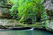
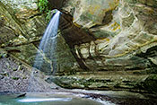
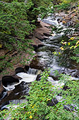
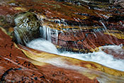
 #5075 Holgate Glacier and Waterfall (Jun 29, 2009), Kenai Fjords National Park -- Cruise, Seward, AK, 3
 Larger
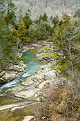
 #5100 Exit Glacier Reflected in the Resurrection River (Jul 01, 2009), Kenai Fjords National Park -- Exit Glacier, Seward, AK, 3
 Larger
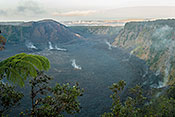
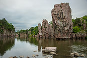
 #5072 Aialik Tidewater Glacier (Jun 29, 2009), Kenai Fjords National Park -- Cruise, Seward, AK, 3
 Larger
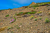
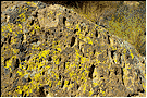
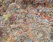
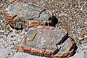
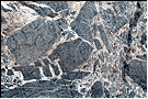
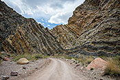
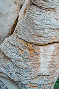
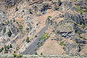
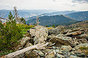
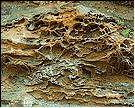
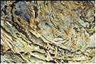
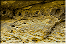
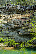
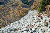
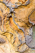
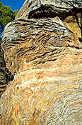
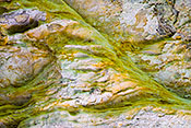
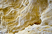
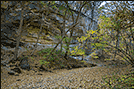
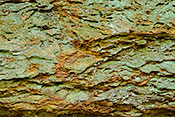
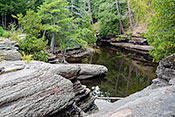
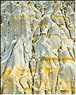
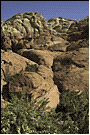
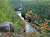
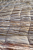
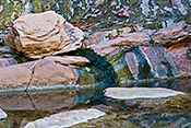
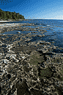
 #5069 Tilted Sedimentary Rock (Jun 29, 2009), Kenai Fjords National Park -- Cruise, Seward, AK, 2
 Larger
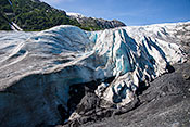
 #5101 Exit Glacier Close Up (Jul 01, 2009), Kenai Fjords National Park -- Exit Glacier, Seward, AK, 3
 Larger
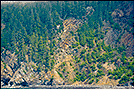
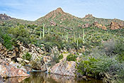
 #5081 Cirque Glaciers and Fishing Boat (Jun 29, 2009), Kenai Fjords National Park -- Cruise, Seward, AK, 3
 Larger
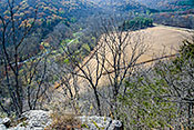
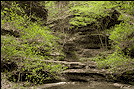
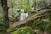
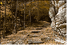
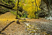
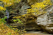
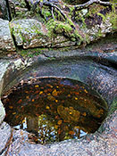
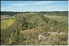
 #4072 Looking Down on Falling Water Creek (Mar 21, 2006), Ozark National Forest -- Falling Water Creek, Ben Hur, AR, 3
 Larger
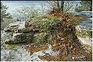
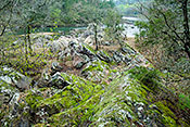
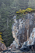
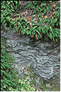
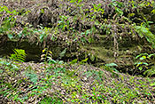
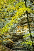
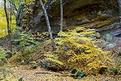
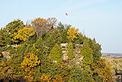
 #3962 Bluff top with Moss, Lichen, and Leaves (Mar 31, 2006), Calico Rock, Calico Rock, AR, 3
 Larger
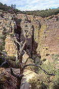
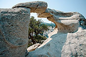
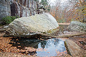
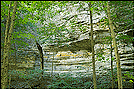
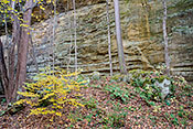
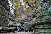
 #3959 Under the Natural Bridge (Mar 28, 2006), Ozark National Forest -- Alum Cove, Deer, AR, 2
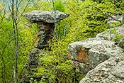
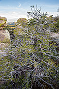
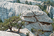
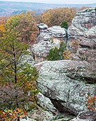
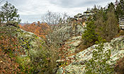
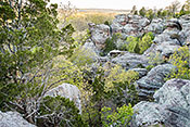
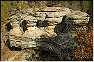
#4325 Pedestal Rock at the Bluff Edge (Apr 03, 2007), Ozark National Forest -- Pedestal Rock Trail, Dover, AR, 2
 Larger
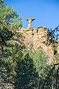
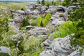
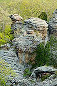
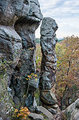
 #4324 Pedestal Rock in the Forest (Apr 03, 2007), Ozark National Forest -- Pedestal Rock Trail, Dover, AR, 3
 Larger
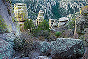
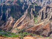
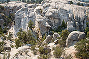
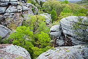
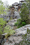
 #3972 Rocky Slope of Devil's Knob (Mar 29, 2006), Devil's Knob Area, Melbourne, AR, 2
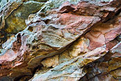
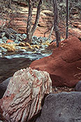
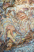
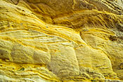
#1557 Colorful Sandstone Outcrop (Apr 06, 2011), Petit Jean State Park, Morrilton, AR, 4
 Larger
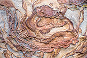
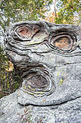
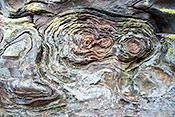
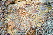
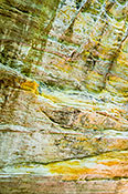
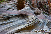
 #4314 Anthropomorphic Liesegang Bands (Mar 26, 2007), Petit Jean State Park, Morrilton, AR, 2
 Larger
 #4307 Sandstone in the River's Path (Mar 28, 2007), Cossatot River State Park Natural Area, Wickes, AR, 2
 Larger
 #4306 Cossatot River Shore (Mar 28, 2007), Cossatot River State Park Natural Area, Wickes, AR, 4
 Larger
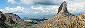
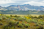
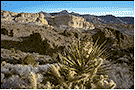
 #3401 Weaver's Needle Panorama (Feb 23, 2005), Tonto NF Superstition Wilderness Area, Apache Junction, AZ, 4
 Larger
 #5228 Miniature Waterfall over Colorful Volcanic Rocks (Feb 24, 2010), Tonto NF Superstition Wilderness Area, Apache Junction, AZ, 4
 Larger
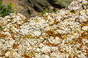
 #4214 Breccia Boulder Covered with Lichen (Feb 24, 2007), Tonto NF Superstition Wilderness Area, Apache Junction, AZ, 2
 Larger
 #3812 Enjoying the View of Weaver's Needle (Dec 09, 2005), Tonto NF Superstition Wilderness Area, Apache Junction, AZ, 2
 Larger
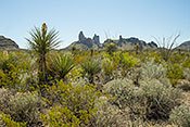
 #3811 Weaver's Needle and Pinyon Pine (Dec 09, 2005), Tonto NF Superstition Wilderness Area, Apache Junction, AZ, 4
 Larger
 #3398 Dog Rock (Feb 23, 2005), Tonto NF Superstition Wilderness Area, Apache Junction, AZ, 4
 Larger
 #3399 Looking Back South along the Peralta Trail (Feb 23, 2005), Tonto NF Superstition Wilderness Area, Apache Junction, AZ, 2
 Larger
 #3532 Peralta Trail from a Distance (Mar 25, 2005), Tonto NF Superstition Wilderness Area, Apache Junction, AZ, 4
 Larger
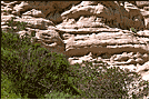
 #5225 Volcanic Rock Spotted with Lichen (Feb 24, 2010), Tonto NF Superstition Wilderness Area, Apache Junction, AZ, 4
 Larger
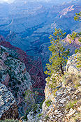
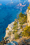
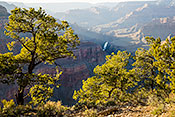
 #1884 Pine on the Edge of a Slippery Slope (Apr 12, 2012), Grand Canyon West Rim Drive, Grand Canyon, AZ, 3
 Larger
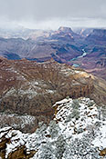
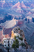
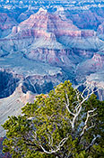
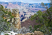
 #1870 Cardenas Buttes from a Snowy Navajo Point (Apr 14, 2012), Grand Canyon South Rim AZ 64 Area, Grand Canyon, AZ, 4
 Larger
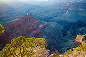
 #1871 Canyon Shadows (Apr 14, 2012), Grand Canyon South Rim AZ 64 Area, Grand Canyon, AZ, 4
 Larger
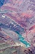
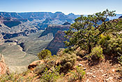
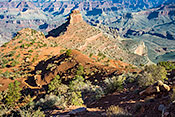
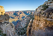
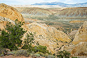
 #1918 Mineral Canyon (Apr 13, 2012), Grand Canyon South Rim AZ 64 Area, Grand Canyon, AZ, 4
 Larger
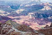
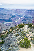
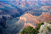
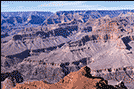
 #1916 Cardenas Butte and Canyon from Lipan Point (Apr 13, 2012), Grand Canyon South Rim AZ 64 Area, Grand Canyon, AZ, 4
 Larger
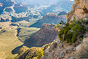
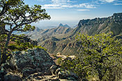
 #1877 Descending the Kaibob 3 -- Looking into the Depths (Apr 07, 2009), Grand Canyon South Rim AZ 64 Area, Grand Canyon, AZ, 4
 Larger
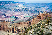
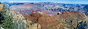
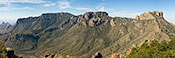
 #1888 Navajo Point Panorama (Apr 15, 2012), Grand Canyon South Rim AZ 64 Area, Grand Canyon, AZ, 4
 Larger
 #1889 View from Pima Point at Dusk (Apr 07, 2009), Grand Canyon West Rim Drive, Grand Canyon, AZ, 4
 Larger
 #1886 From Desert View at Dawn (Apr 13, 2012), Grand Canyon South Rim AZ 64 Area, Grand Canyon, AZ, 4
 Larger
 #1883 Descending the Kaibob 9 -- The View from Cedar Ridge (Apr 07, 2009), Grand Canyon South Rim AZ 64 Area, Grand Canyon, AZ, 4
 Larger
 #1887 Hermit Road Greenway View (Apr 07, 2009), Grand Canyon West Rim Drive, Grand Canyon, AZ, 4
 Larger
 #1882 Descending the Kaibob 8 -- Cedar Ridge (Apr 07, 2009), Grand Canyon South Rim AZ 64 Area, Grand Canyon, AZ, 4
 Larger
 #4670 Late Afternoon Light at Hopi Point (Apr 06, 2009), Grand Canyon West Rim Drive, Grand Canyon, AZ, 4
 Larger
 #4671 Pima Point Afterglow (Apr 07, 2009), Grand Canyon West Rim Drive, Grand Canyon, AZ, 4
 Larger
 #4672 Colors at Dusk (Apr 06, 2009), Grand Canyon West Rim Drive, Grand Canyon, AZ, 4
 Larger
 #4673 Pine Tree in the Canyon (Apr 06, 2009), Grand Canyon West Rim Drive, Grand Canyon, AZ, 4
 Larger
 #1875 Descending the Kaibob 2 -- Switchback Example (Apr 07, 2009), Grand Canyon South Rim AZ 64 Area, Grand Canyon, AZ, 4
 Larger
 #2781 Granite Rapids from Pima Point (Feb 21, 2003), Grand Canyon West Rim Drive, Grand Canyon, AZ, 2
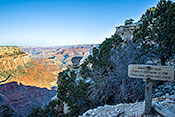
#1874 Descending the Kaibob 1 -- Mule Warning Sign (Apr 07, 2009), Grand Canyon South Rim AZ 64 Area, Grand Canyon, AZ, 4
 Larger
 #2782 Panorama from Pima Point (Feb 21, 2003), Grand Canyon West Rim Drive, Grand Canyon, AZ, 2
 Larger
 #1920 Crisp Morning at Moran Point (Apr 15, 2012), Grand Canyon South Rim AZ 64 Area, Grand Canyon, AZ, 3
 Larger
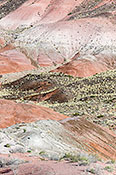
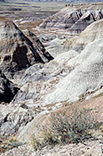
 #5984 Painted Desert Pink and Blue (Apr 03, 2012), Petrified Forest National Park, Holbrook, AZ, 3
 Larger
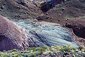
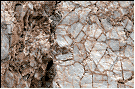
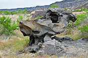
 #5993 Petrified Wood Emerging from Mudstone (Apr 03, 2012), Petrified Forest National Park, Holbrook, AZ, 3
 Larger
 #5992 Petrified Wood Slabs (Apr 03, 2012), Petrified Forest National Park, Holbrook, AZ, 3
 Larger
 #5994 Sand and Mudstone of the Chinle Formation (Apr 03, 2012), Petrified Forest National Park, Holbrook, AZ, 3
 Larger
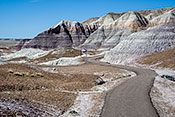
 #5987 Blue Mesa Badlands Trail (Apr 03, 2012), Petrified Forest National Park, Holbrook, AZ, 3
 Larger
 #1902 Pieces of Petrified Wood in the Snow (Dec 10, 2001), Petrified Forest National Park, Holbrook, AZ, 2
 Larger
 #5989 Blue Mesa Badlands Panorama (Apr 03, 2012), Petrified Forest National Park, Holbrook, AZ, 3
 Larger
 #5983 Painted Desert Beige and Brown (Apr 03, 2012), Petrified Forest National Park, Holbrook, AZ, 3
 Larger
 #5991 Looking into the Blue Mesa Badlands (Apr 03, 2012), Petrified Forest National Park, Holbrook, AZ, 3
 Larger
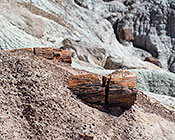
 #5988 Petrified Wood in Ravine (Apr 03, 2012), Petrified Forest National Park, Holbrook, AZ, 3
 Larger
 #1901 Petrified Log in the Snow (Dec 10, 2001), Petrified Forest National Park, Holbrook, AZ, 2
#6004 Edge of the Blue Mesa (Apr 03, 2012), Petrified Forest National Park, Holbrook, AZ, 3
 Larger
 #5990 Blue Mesa Badlands Overlook (Apr 03, 2012), Petrified Forest National Park, Holbrook, AZ, 3
 Larger
 #1864 Horse Grazing in front of Butte (Mar 21, 1999), Monument Valley, Kayenta, AZ, 2
#2788 Mohave Yucca and Rock Formations (Feb 22, 2003), Warm Springs Wilderness / Oatman, Kingman, AZ, 2
 Larger
 #3406 The White Tank with Waterfalls (Feb 25, 2005), White Tank Mountain Regional Park, Phoenix, AZ, 3
 Larger
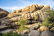
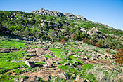
 #4651 Boulders in the Making (Mar 31, 2009), Prescott NF Granite Dells, Prescott, AZ, 3
 Larger
 #4650 Dead Pine in the Granite Dells (Mar 31, 2009), Prescott NF Granite Dells, Prescott, AZ, 3
 Larger
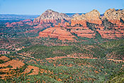
 #2776 Sedona from the Schnebley Hill Vista (Apr 22, 2012), Coconino National Forest -- Schnebley Hill Road, Sedona, AZ, 3
 Larger
 #4666 Cathedral Rock and Cottonwoods (Apr 03, 2009), Coconino National Forest -- Red Rock Loop, Sedona, AZ, 3
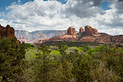 Larger
 #4667 Cathedral Rock in the Red Rock Landscape (Apr 03, 2009), Coconino National Forest -- Red Rock Loop, Sedona, AZ, 3
 Larger
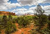
 #2778 Variety of Rock Types (Feb 20, 2003), Coconino National Forest -- Oak Creek Canyon, Sedona, AZ, 3
 Larger
 #2771 Rock Formation and Lichen (Feb 19, 2003), Carr Canyon and Mountain, Sierra Vista, AZ, 3
 Larger
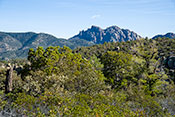
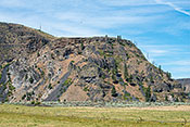
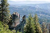
 #3027 Sugarloaf and Cochise Head from Inspiration Point (Mar 30, 2011), Chiricahau National Monument, Willcox, AZ, 4
 Larger
 #2942 Massai Point Overlooking Sulfur Springs Valley (Mar 31, 2011), Chiricahau National Monument, Willcox, AZ, 4
 Larger
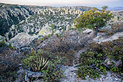
 #3023 Morning Light on the Massai Point Trail (Mar 31, 2011), Chiricahau National Monument, Willcox, AZ, 4
 Larger
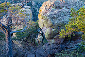
 #3025 Cochise Head Rock Formation (Mar 30, 2011), Chiricahau National Monument, Willcox, AZ, 4
 Larger
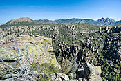
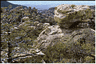
 #2957 View from Massai Point (Mar 21, 2004), Chiricahau National Monument, Willcox, AZ, 2
 Larger
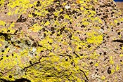
 #3019 Lichen on Rhyolite (Mar 31, 2011), Chiricahau National Monument, Willcox, AZ, 4
 Larger
 #3010 Alligator Juniper among the Rocks (Mar 31, 2011), Chiricahau National Monument, Willcox, AZ, 4
 Larger
 #3028 Mushroom Rock Formation (Mar 30, 2011), Chiricahau National Monument, Willcox, AZ, 4
 Larger
 #2956 Balanced Rock Overlook (Mar 31, 2011), Chiricahau National Monument, Willcox, AZ, 4
 Larger
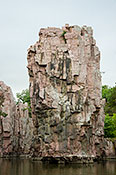
 #1237 Indian Profile Rock Formation (Jun 09, 2009), Chatham Sound, Prince Rupert, BC, 3
 Larger
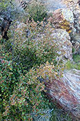
 #3597 Lichen on Conglomerate Boulder (Apr 13, 2005), Anza-Borrego Desert Cool Canyon, Borrego Springs, CA, 3
 Larger
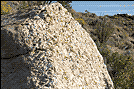
 #3598 Conglomerate Rock on Granite Boulder (Apr 13, 2005), Anza-Borrego Desert Cool Canyon, Borrego Springs, CA, 2
 Larger
 #1488 Anticline along Split Mountain Road (Mar 10, 2001), Anza-Borrego Desert, Borrego Springs, CA, 2
#7609 Desert Apricot in a Granite Boulder Filled Canyon (Mar 06, 2023), Anza-Borrego Desert Cool Canyon, Borrego Springs, CA, 3
 Larger
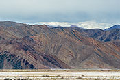
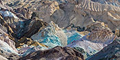
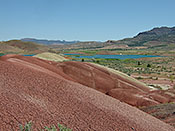
 #5248 Multicolored Striped Hill (Mar 06, 2010), Death Valley NP, Furnace Creek, CA, 4
 Larger
 #5251 Artists Palette Panorama (Mar 07, 2010), Death Valley NP, Furnace Creek, CA, 4
 Larger
 #5247 Creosote Shrubs and Volcanic Hills (Mar 06, 2010), Death Valley NP, Furnace Creek, CA, 2
 Larger
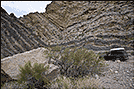
 #3463 Titus Canyon Polished Wall (Mar 16, 2005), Death Valley NP Titus Canyon (Amagorsa Mtns.), Inyo County, CA, 2
 Larger
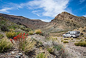
 #1510 Volcanic Mountains (Apr 15, 2009), Death Valley NP Titus Canyon (Amagorsa Mtns.), Inyo County, CA, 2
 Larger
 #1513 Syncline (Apr 15, 2009), Death Valley NP Titus Canyon (Amagorsa Mtns.), Inyo County, CA, 2
 Larger
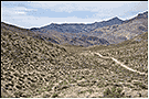
 #1514 Sagebrush Valley Traversed by Titus Canyon Road (Apr 15, 2009), Death Valley NP Titus Canyon (Amagorsa Mtns.), Inyo County, CA, 2
 Larger
 #1516 Mountain with Layers Showing Desert, Ocean, and Volcanism (Apr 15, 2009), Death Valley NP Titus Canyon (Amagorsa Mtns.), Inyo County, CA, 4
 Larger
 #3462 Titus Canyon Wall Undercut by Water Erosion (Mar 16, 2005), Death Valley NP Titus Canyon (Amagorsa Mtns.), Inyo County, CA, 2
 Larger
 #3461 Titus Canyon Wall (Mar 16, 2005), Death Valley NP Titus Canyon (Amagorsa Mtns.), Inyo County, CA, 2
 Larger
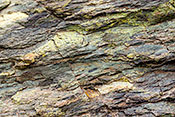
 #3460 Titus Canyon Wall Detail (Mar 16, 2005), Death Valley NP Titus Canyon (Amagorsa Mtns.), Inyo County, CA, 2
 Larger
 #1542 Entering Titus Canyon (Apr 15, 2009), Death Valley NP Titus Canyon (Amagorsa Mtns.), Inyo County, CA, 4
 Larger
 #2748 Eroded Sandstone Formations (Mar 10, 2003), Whiting Wilderness Park, Lake Forest, CA, 2
 Larger
 #3050 Tufa Towers at Dawn (Apr 19, 2004), Mono Lake, Lee Vining, CA, 3
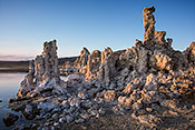 Larger
 #3051 Tufa Towers with the High Sierras Behind (Apr 19, 2004), Mono Lake, Lee Vining, CA, 3
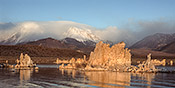 Larger
 #3054 Tufa Glowing at Sunrise (Apr 19, 2004), Mono Lake, Lee Vining, CA, 2
#3055 Salt Encrusted Branches (Apr 19, 2004), Mono Lake, Lee Vining, CA, 2
#2183 Indian Hill (Mar 08, 2003), Anza-Borrego Desert Piedras Grandes, Ocotillo, CA, 2
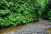
#3141 Canyon Wall Densely Covered with Ferns (May 14, 2009), Prairie Creek Redwoods Fern Canyon, Orick, CA, 4
 Larger
 #2008 Miniature Lupine and Yellow Carpet Showing Bare Basalt (Mar 26, 2002), Oroville Table Mountain, Oroville, CA, 2
 Larger
 #2017 Table Mountain Draw showing Basalt Outcrop (Mar 26, 2002), Oroville Table Mountain, Oroville, CA, 2
#1543 Aguereberry Point View (Apr 15, 2009), Death Valley NP Panamint Mountains, Panamint Springs, CA, 4
 Larger
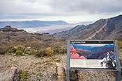
 #1505 Sign at Aguereberry Point (Apr 15, 2009), Death Valley NP Panamint Mountains, Panamint Springs, CA, 3
 Larger
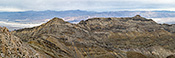
 #1547 Aguereberry Panorama (Apr 15, 2009), Death Valley NP Panamint Mountains, Panamint Springs, CA, 3
 Larger
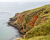
 #4746 Red Cliffs Near Chimney Rock (Apr 30, 2009), Point Reyes National Seashore, Point Reyes Station, CA, 4
 Larger
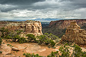
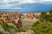
 #1853 View from the End of the Otto Trail (Apr 24, 2005), Colorado National Monument, Fruita, CO, 3
 Larger
 #1854 Monument Canyon on a Stormy Day (Apr 24, 2005), Colorado National Monument, Fruita, CO, 3
 Larger
 #5909 Coquina -- Poorly Cemented Limestone (Nov 04, 2011), Castillo de San Marcos National Monument, Saint Augustine, FL, 3
 Larger
 #4506 Manuka Pit Crater Trail Stop (Feb 06, 2008), Manuka State Park and Natural Area, Captain Cook, HI, 2
 Larger
 #6961 Great Wall with Red Oxidized Stone (Mar 19, 2019), Pu'uhonua o Honaunau National Historic Park, Captain Cook, HI, 3
 Larger
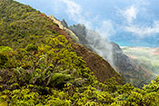
 #4483 Pali (Cliffs) in the Clouds (Jan 21, 2008), Kalalau Valley, Haena, HI, 3
 Larger
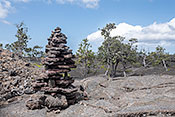
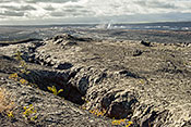
 #6957 Pu'u o Lokuana Trail Cairn at Lava Types Divide (Apr 04, 2019), Kahuku Unit Hawaii Volcanoes National Park, Naalehu, HI, 3
 Larger
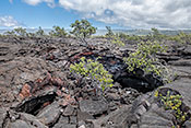
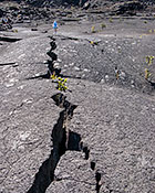
 #6959 Lava Tubes Along the Pu'u o Lokuana Trail (Apr 04, 2019), Kahuku Unit Hawaii Volcanoes National Park, Naalehu, HI, 3
 Larger
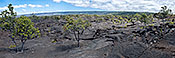
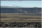
 #6971 1868 Lava Flow Panorama (Apr 05, 2019), Kahuku Unit Hawaii Volcanoes National Park, Naalehu, HI, 3
 Larger
 #4466 Tree Mold (Jan 09, 2008), Mauna Loa Road Hawaii Volcano National Park, Volcano, HI, 2
 Larger
 #4446 Caldera Floor with Deep Vent (Jan 08, 2008), Kilauea Caldera Hawaii Volcanoes National Park, Volcano, HI, 3
 Larger
 #4447 Caldera with Mauna Kea in the Distance (Jan 08, 2008), Kilauea Caldera Hawaii Volcanoes National Park, Volcano, HI, 2
 Larger
 #4450 Steam Vents Detail (Jan 08, 2008), Kilauea Caldera Hawaii Volcanoes National Park, Volcano, HI, 2
 Larger
 #4453 Crossing Kilauea Iki Crater (Jan 08, 2008), Kilauea Iki Area Hawaii Volcanoes National Park, Volcano, HI, 3
 Larger
 #4452 Kilauea Iki Crater at Dawn (Jan 09, 2008), Kilauea Iki Area Hawaii Volcanoes National Park, Volcano, HI, 3
 Larger
 #7761 Canyon Wall from the Trail (Jan 20, 2008), Waimea Canyon, Waimea, HI, 3
 Larger
 #5773 Paint Creek Valley from the Larkin Overlook (Oct 20, 2010), Yellow River State Forest, Marquette, IA, 3
 Larger
 #6716 Multicolored Lichen on Granite (Jul 18, 2014), City of Rocks National Reserve, Almo, ID, 3
 Larger
 #6717 City of Rocks Window Arch (Jul 18, 2014), City of Rocks National Reserve, Almo, ID, 3
 Larger
 #6719 Pine by Granite Rock Formations (Jul 18, 2014), City of Rocks National Reserve, Almo, ID, 3
 Larger
 #6720 Granite Spires and Joints (Jul 18, 2014), City of Rocks National Reserve, Almo, ID, 3
 Larger
 #440 Irrigated Field with Dry Hill Behind (Jul 05, 2014), Blacks Creek Road, Boise, ID, 3
 Larger
 #444 Hillside with Exposed Basalt Columns (Jul 05, 2014), Blacks Creek Road, Boise, ID, 3
 Larger
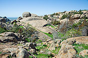
 #6663 Granite Rock Formations (Jul 07, 2014), Mores Mountain in Shafer Butte Recreation Area, Boise, ID, 3
 Larger
 #6068 Natural Volcanic Sculpture (May 03, 2012), Snake River Birds of Prey Conservation Area, Kuna, ID, 3
 Larger
 #6372 Ascending to the Heaven's Gate Lookout 2 - Colorful Boulder (Aug 22, 2013), Hells Canyon NRA Seven Devils Recreation Site, Riggins, ID, 3
 Larger
 #6373 Ascending to the Heaven's Gate Lookout 3 - Rock Jumble (Aug 22, 2013), Hells Canyon NRA Seven Devils Recreation Site, Riggins, ID, 3
 Larger
 #5612 Shootingstar Blooming by Glacial Erratic (May 10, 2018), Dixie Briggs Fromm, Algonquin, IL, 3
 Larger
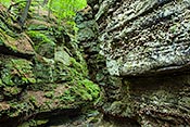
 #4004 Eroded Sandstone Wall (Nov 04, 2006), Giant City State Park, Carbondale, IL, 3
 Larger
 #4120 Stone Junction (Nov 04, 2006), Giant City State Park, Carbondale, IL, 2
 Larger
 #4119 Eroded Sandstone and Lichen (Nov 04, 2006), Giant City State Park, Carbondale, IL, 2
 Larger
 #2576 Colorful Sandstone Surface (Oct 26, 2005), Devil's Kitchen Lake, Carbondale, IL, 2
 Larger
 #2570 Sandstone Wall with Interesting Layers (Oct 26, 2005), Devil's Kitchen Lake, Carbondale, IL, 2
 Larger
 #2558 Moss and Lichen Covered Rim (Oct 29, 2003), Lusk Creek Canyon Nature Preserve, Eddyville, IL, 2
 Larger
 #4343 Lusk Creek Canyon Wall with Ice (Apr 07, 2007), Lusk Creek Canyon Nature Preserve, Eddyville, IL, 3
 Larger
 #942 Devil's Backbone in Bay Creek (Nov 04, 2014), Shawnee NF -- Bell Smith Springs, Eddyville, IL, 3
 Larger
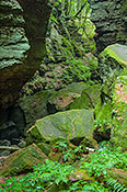
 #4340 Little Grand Canyon Ravine (Apr 10, 2007), Shawnee NF -- Little Grand Canyon, Etherton, IL, 2
 Larger
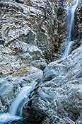
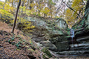
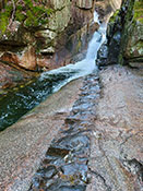
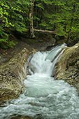
 #5945 Side Falls Outflow (Apr 28, 2014), Shawnee NF -- Burden Falls Wilderness, Harrisburg, IL, 3
 Larger
 #3986 Burden Falls Natural Amphitheater (Apr 08, 2006), Shawnee NF -- Burden Falls Wilderness, Harrisburg, IL, 2
#944 Sandstone Bluff Overlooking Oak Woodland (Nov 03, 2014), Shawnee NF -- Burden Falls Wilderness, Harrisburg, IL, 3
 Larger
 #6560 Burden Falls in the Landscape (Apr 28, 2014), Shawnee NF -- Burden Falls Wilderness, Harrisburg, IL, 3
 Larger
 #4108 Liesegang Details (Nov 05, 2014), Shawnee NF -- Garden of the Gods, Mitchellsville, IL, 3
 Larger
 #4002 Liesegang Bands Formation (Apr 08, 2006), Shawnee NF -- Garden of the Gods, Mitchellsville, IL, 2
 Larger
 #1640 Valley View in Spring (Apr 16, 2011), Shawnee NF -- Garden of the Gods, Mitchellsville, IL, 4
 Larger
 #2596 The Scream Sandtone Formation (Nov 03, 2014), Shawnee NF -- Garden of the Gods, Mitchellsville, IL, 3
 Larger
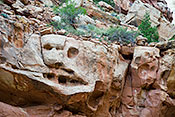
 #2553 Face in the Rocks (Oct 28, 2005), Shawnee NF -- Garden of the Gods, Mitchellsville, IL, 2
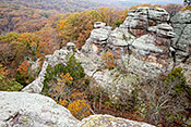
 Larger
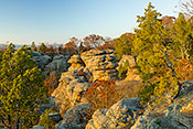
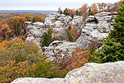
 #2549 Overview (Oct 28, 2005), Shawnee NF -- Garden of the Gods, Mitchellsville, IL, 4
 Larger
 #2577 Camel Rock in Sunset Light (Oct 29, 2010), Shawnee NF -- Garden of the Gods, Mitchellsville, IL, 4
 Larger
 #2589 Colorful Sandstone Ridges (Oct 30, 2010), Shawnee NF -- Garden of the Gods, Mitchellsville, IL, 4
 Larger
 #2555 Liesegang Bands (Oct 27, 2005), Shawnee NF -- Garden of the Gods, Mitchellsville, IL, 2
 Larger
 #2551 Liesagang Bands in Context (Oct 29, 2010), Shawnee NF -- Garden of the Gods, Mitchellsville, IL, 4
 Larger
 #4113 Sandstone Formations in Fall (Nov 08, 2006), Shawnee NF -- Garden of the Gods, Mitchellsville, IL, 4
 Larger
 #1641 Camel Rock and Spring Foliage (Apr 16, 2011), Shawnee NF -- Garden of the Gods, Mitchellsville, IL, 4
 Larger
 #2552 Camel Rock Formation (Nov 05, 2014), Shawnee NF -- Garden of the Gods, Mitchellsville, IL, 4
 Larger
 #2548 Camel Rock Detail (Apr 27, 2014), Shawnee NF -- Garden of the Gods, Mitchellsville, IL, 3
 Larger
 #1672 View from the Deck (Nov 06, 2006), Shawnee NF -- Garden of the Gods, Mitchellsville, IL, 3
 Larger
 #4001 Deep Liesegang Bands (Nov 03, 2014), Shawnee NF -- Garden of the Gods, Mitchellsville, IL, 3
 Larger
 #3999 Liesegang Bands Abstract (Nov 03, 2014), Shawnee NF -- Garden of the Gods, Mitchellsville, IL, 4
 Larger
 #2556 Cork in the Bottle (Oct 29, 2003), Shawnee NF -- Garden of the Gods, Mitchellsville, IL, 2
 Larger
 #4000 Camel Rock in a Huge Landscape (Apr 26, 2014), Shawnee NF -- Garden of the Gods, Mitchellsville, IL, 3
 Larger
 #2554 The Smokestack (Nov 03, 2014), Shawnee NF -- Garden of the Gods, Mitchellsville, IL, 3
 Larger
 #4116 Viewing Deck over Ravine (Nov 08, 2006), Shawnee NF -- Garden of the Gods, Mitchellsville, IL, 2
 Larger
 #5746 Sandstone Formation in Spring (Apr 24, 2010), Shawnee NF -- Garden of the Gods, Mitchellsville, IL, 3
 Larger
 #2546 Lichen on Sandstone (Apr 24, 2010), Shawnee NF -- Garden of the Gods, Mitchellsville, IL, 4
 Larger
 #1004 Bizarre Rock Formations in Spring (Apr 27, 2014), Shawnee NF -- Garden of the Gods, Mitchellsville, IL, 3
 Larger
 #987 Camel Rock in an Autumn Landscape (Nov 08, 2018), Shawnee NF -- Garden of the Gods, Mitchellsville, IL, 3
 Larger
 #948 Sandstone Towers in Autumn (Nov 05, 2014), Shawnee NF -- Garden of the Gods, Mitchellsville, IL, 3
 Larger
 #7669 Sandstone Outcrop Microcosm (Aug 19, 2023), Nachusa Grasslands Thelma Carpenter Prairie, Nachusa, IL, 3
 Larger
 #7677 Sanstone Outcrop under Oaks (Aug 19, 2023), Nachusa Grasslands Stone Barn Savanna, Nachusa, IL, 3
 Larger
 #7416 Sandstone Wall Covered with Ferns (Oct 15, 2021), Castle Rock State Park, Oregon, IL, 3
 Larger
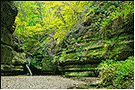
 #732 Sandstone Amphitheater (Sep 25, 2006), Starved Rock State Park, Ottawa, IL, 2
 Larger
 #612 Illinois Canyon in Spring (May 10, 2007), Starved Rock State Park, Ottawa, IL, 4
 Larger
 #726 Colorful Stains on Sandstone Council Overhang Ceiling (May 15, 2005), Starved Rock State Park, Ottawa, IL, 4
 Larger
 #785 Council Overhang in Autumn (Oct 21, 2010), Starved Rock State Park, Ottawa, IL, 2
 Larger
 #739 Swirling Sandstone Patterns (Feb 13, 2009), Starved Rock State Park, Ottawa, IL, 3
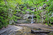
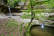
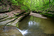
 Larger
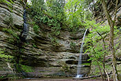
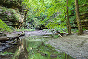
 #737 Ottawa Falls and Grotto (Jul 20, 2007), Starved Rock State Park, Ottawa, IL, 3
 Larger
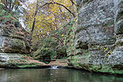
 #4089 Ottawa Canyon Entrance (Oct 25, 2006), Starved Rock State Park, Ottawa, IL, 4
 Larger
 #791 Ottawa Canyon in Autumn (Oct 21, 2010), Starved Rock State Park, Ottawa, IL, 2
 Larger
 #4093 Sandstone Wall Framed by Maple (Oct 25, 2006), Starved Rock State Park, Ottawa, IL, 3
 Larger
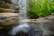
 #4094 Ottawa Canyon Falls In Autumn (Oct 25, 2006), Starved Rock State Park, Ottawa, IL, 3
 Larger
 #731 Eroded Sandstone (Sep 25, 2006), Starved Rock State Park, Ottawa, IL, 3
 Larger
 #5734 Ottawa Canyon Amphitheater (Apr 16, 2010), Starved Rock State Park, Ottawa, IL, 2
 Larger
 #4097 Natural Amphitheater and Stream (Oct 25, 2006), Starved Rock State Park, Ottawa, IL, 3
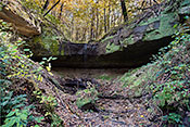
 Larger
 #4592 Kaskaskia Canyon Floor (Oct 17, 2008), Starved Rock State Park, Ottawa, IL, 2
 Larger
 #595 Breakaway Boulder (Oct 25, 2006), Starved Rock State Park, Ottawa, IL, 2
 Larger
 #6581 Wildcat Canyon in Spring (May 15, 2014), Starved Rock State Park, Ottawa, IL, 3
 Larger
 #6583 Wildcat Canyon Outflow (May 15, 2014), Starved Rock State Park, Ottawa, IL, 3
 Larger
 #6590 LaSalle Canyon in Spring (May 14, 2014), Starved Rock State Park, Ottawa, IL, 3
 Larger
 #5350 Box Canyon with Liverwort Covered Walls (Oct 18, 2016), Starved Rock State Park, Ottawa, IL, 2
 Larger
 #6592 LaSalle Canyon Outflow (May 14, 2014), Starved Rock State Park, Ottawa, IL, 3
 Larger
 #5355 The Starved Rock Promontory (Nov 01, 2016), Starved Rock State Park, Ottawa, IL, 3
 Larger
 #5370 Natural Berm in Illinois Canyon (Oct 31, 2016), Starved Rock State Park, Ottawa, IL, 3
 Larger
 #5420 Striped Sandstone Wall in Ottawa Canyon (May 18, 2017), Starved Rock State Park, Ottawa, IL, 3
 Larger
 #5375 Kaskaskia Canyon in Fall (Oct 31, 2016), Starved Rock State Park, Ottawa, IL, 2
 Larger
 #5377 Ottawa Canyon in Autumn (Oct 31, 2016), Starved Rock State Park, Ottawa, IL, 2
 Larger
 #5419 Kaskaskia Canyon Stream (May 18, 2017), Starved Rock State Park, Ottawa, IL, 3
 Larger
 #5379 Head of Illinois Canyon in Autumn (Oct 31, 2016), Starved Rock State Park, Ottawa, IL, 3
 Larger
 #6591 LaSalle Canyon from Behind the Falls (May 14, 2014), Starved Rock State Park, Ottawa, IL, 3
 Larger
 #6572 Sandstone Canyons Wall Covered with Lichen (May 08, 2014), Turkey Run State Park, Marshall, IN, 3
 Larger
 #5856 Forest from Chimney Top (Oct 21, 2011), Red River Gorge Chimney Top, Stanton, KY, 3
 Larger
 #5860 Angel Window (Oct 22, 2011), Red River Gorge, Stanton, KY, 2
 Larger
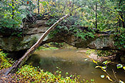
 #5844 Rock Bridge over Swift Camp Creek (Oct 19, 2011), Red River Gorge Rock Bridge Trail, Stanton, KY, 3
 Larger
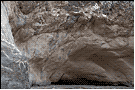
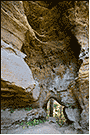
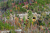
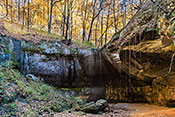
 #5851 Cliffside Caves (Oct 21, 2011), Red River Gorge Tunnel Ridge Road, Stanton, KY, 3
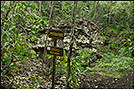
 Larger
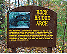
 #5845 Rock Bridge Educational Sign (Oct 19, 2011), Red River Gorge Rock Bridge Trail, Stanton, KY, 2
 Larger
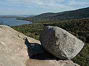
 #3226 Bubble Rock (Oct 06, 2004), Acadia National Park, Ellsworth, ME, 3
 Larger
 #5494 Spruce Seedling on Lake Superior Conglomerate (Jul 24, 2017), Keweenaw Peninsula, Baraga and Ontonagon, MI, 3
 Larger
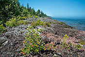
 #5493 Ox-eye Daisies on the Lake Superior Conglomerate (Jul 24, 2017), Keweenaw Peninsula, Baraga and Ontonagon, MI, 3
 Larger
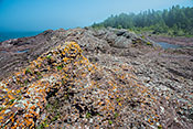
 #5492 Orange Lichen on Lake Superior Conglomerate Rock (Jul 24, 2017), Keweenaw Peninsula, Baraga and Ontonagon, MI, 3
 Larger
 #5491 Conglomerate Rock on the Lake Superior Shore (Jul 24, 2017), Keweenaw Peninsula, Baraga and Ontonagon, MI, 3
 Larger
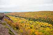
 #5564 Conglomerate Rock Ridge Overlooks Hardwood Forest (Oct 13, 2017), Brockway Mountain Drive, Copper Harbor, MI, 3
 Larger
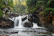
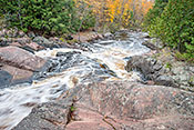
 #1983 7. Descending to Sturgeon Falls -- The Falls (Oct 08, 2015), Baraga County, L'Anse, MI, 3
 Larger
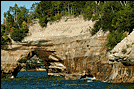
 #3213 Natural Arch on the Shore (Sep 24, 2004), Pictured Rocks National Lakeshore, Munising, MI, 2
 Larger
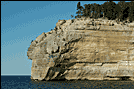
 #3216 Indian Point (Sep 24, 2004), Pictured Rocks National Lakeshore, Munising, MI, 2
 Larger
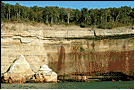
 #3215 Iron Stains and Forest Edge (Sep 24, 2004), Pictured Rocks National Lakeshore, Munising, MI, 2
 Larger
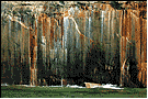
 #3214 Copper and Iron Stains on Sandstone Cliff (Sep 24, 2004), Pictured Rocks National Lakeshore, Munising, MI, 2
 Larger
 #1935 Manido Falls from the East Side Trail (Oct 05, 2015), Porcupine Mountains - Presque Isle, Ontonagon, MI, 3
 Larger
 #1937 Nawadaha Falls in Context (Oct 05, 2015), Porcupine Mountains - Presque Isle, Ontonagon, MI, 3
 Larger
 #1924 River Potholes Close-up (Oct 05, 2015), Porcupine Mountains - Presque Isle, Ontonagon, MI, 3
 Larger
 #1951 Escarpment from the Carp River (Oct 06, 2015), Porcupine Mountains - Big Carp River, Ontonagon, MI, 3
 Larger
 #1922 Potholes in the Lower Presque Isle River (Oct 05, 2015), Porcupine Mountains - Presque Isle, Ontonagon, MI, 3
 Larger
 #1927 Presque Isle Pool (Oct 05, 2015), Porcupine Mountains - Presque Isle, Ontonagon, MI, 3
 Larger
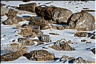
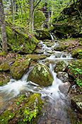
 #1660 Boulder Field (Apr 11, 2011), Johnson's Shut-Ins State Park, Graniteville, MO, 4
 Larger
 #1659 Scour Path (Apr 11, 2011), Johnson's Shut-Ins State Park, Graniteville, MO, 4
 Larger
 #6419 Grinnell Formation Mudstone in the Virginia Creek Bed (Sep 07, 2013), Glacier National Park St. Mary Falls Trail, St. Mary, MT, 4
 Larger
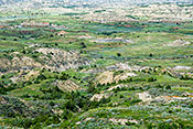
 #5186 Slope with Complex Erosion of Sedimentary Rock (Jul 19, 2009), Theodore Roosevelt National Park, Medora, ND, 4
 Larger
 #5188 Badlands Overview (Jul 19, 2009), Theodore Roosevelt National Park, Medora, ND, 3
 Larger
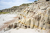
 #5185 Sedimentary Rock Eroded into a Toe (Jul 19, 2009), Theodore Roosevelt National Park, Medora, ND, 4
 Larger
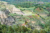
 #6638 Badlands Overlook in a Wet Year (Jun 28, 2014), Theodore Roosevelt National Park, Medora, ND, 4
 Larger
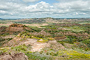
 #6624 Badlands from the I-94 Visitor Center Overlook (Jun 27, 2014), Theodore Roosevelt National Park, Medora, ND, 4
 Larger
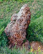
 #6626 Clinker Boulder (Jun 27, 2014), Theodore Roosevelt National Park, Medora, ND, 4
 Larger
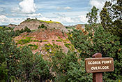
 #6635 Scoria Point Overlook (Jun 27, 2014), Theodore Roosevelt National Park, Medora, ND, 4
 Larger
 #7422 Ascending to Sabbaday Falls 3 (Oct 29, 2021), Kancamagus Highway, Lincoln, NH, 3
 Larger
 #7423 Ascending to Sabbaday Falls 4 (Oct 29, 2021), Kancamagus Highway, Lincoln, NH, 3
 Larger
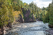
 #4065 A Right Angle Turn on the Pemigewasset River (May 19, 2006), White Mountains of New Hampshire, Sugar Hill, NH, 3
 Larger
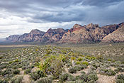
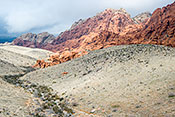
 #3608 The Calico Hills (Apr 10, 2009), Red Rock Canyon National Conservation Area, Las Vegas, NV, 3
 Larger
 #3612 Stansbury Cliffrose at Base of Calico Hills (Apr 18, 2005), Red Rock Canyon National Conservation Area, Las Vegas, NV, 2
 Larger
 #3607 Calico Hills Formations (Mar 08, 2010), Red Rock Canyon National Conservation Area, Las Vegas, NV, 3
 Larger
 #3611 Sandstone Block with Vertical Layers (Apr 18, 2005), Red Rock Canyon National Conservation Area, Las Vegas, NV, 3
 Larger
 #7791 Multicolored Boulders in Dry Creek (Mar 18, 2010), Red Rock Canyon National Conservation Area, Las Vegas, NV, 3
 Larger
 #5980 Elk Mountain from the Trailhead (Apr 01, 2012), Wichita Mountains NWR, Lawton, OK, 3
 Larger
 #5981 Elk Mountain Top (Apr 01, 2012), Wichita Mountains NWR, Lawton, OK, 3
 Larger
 #3189 Sumac on the Rim of Barron Canyon (Sep 28, 2004), Algonquin Provincial Park, Achray Area, Pembroke, ON, 3
 Larger
 #6379 Hells Canyon Geology Sign (Aug 26, 2013), Hells Canyon NRA, Joseph, OR, 3
 Larger
 #3180 Painted Hills and with Lake in the Distance (Jun 17, 2004), John Day Fossil Beds National Monument, Mitchell, OR, 3
 Larger
 #6295 King Rock Along Split Rock Creek (Aug 04, 2013), Palisades State Park, Garretson, SD, 3
 Larger
 #6294 Palisades Along the Split Rock Creek (Aug 04, 2013), Palisades State Park, Garretson, SD, 3
 Larger
 #4245 Yucca and Mule Ears Formation (Mar 07, 2007), Big Bend National Park West Side, Alpine, TX, 3
 Larger
 #4232 Panorama from the Top of the Lost Mine Trail (Mar 06, 2007), Big Bend National Park Chisos Mtns, Alpine, TX, 3
 Larger
 #4233 The Rio Grande Valley from the Lost Mine Trail (Mar 06, 2007), Big Bend National Park Chisos Mtns, Alpine, TX, 3
 Larger
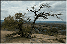
 #4273 View from the Top of Enchanted Rock (Mar 19, 2007), Enchanted Rock State Natural Area, Fredericksburg, TX, 2
 Larger
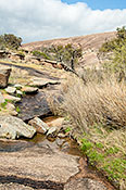
 #4276 Looking up an Enchanted Rock Ravine (Mar 19, 2007), Enchanted Rock State Natural Area, Fredericksburg, TX, 3
 Larger
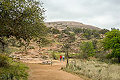
 #4280 Enchanted Rock Summit Trail (Mar 19, 2007), Enchanted Rock State Natural Area, Fredericksburg, TX, 3
 Larger
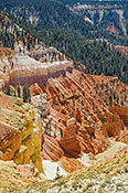
 #6517 Cedar Breaks Amphitheater Overview (Sep 24, 2013), Cedar Breaks National Monument, Cedar City, UT, 3
 Larger
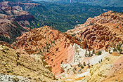
 #6518 Hoodoos in the Cedar Breaks Amphitheater (Sep 24, 2013), Cedar Breaks National Monument, Cedar City, UT, 3
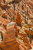 Larger
 #6516 Cedar Breaks Portrait from North View (Sep 24, 2013), Cedar Breaks National Monument, Cedar City, UT, 3
 Larger
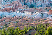
 #1994 Bryce Amphitheater from Sunset Point (Mar 15, 2010), Bryce Canyon National Park, Escalante, UT, 4
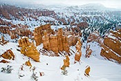 Larger
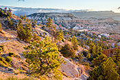
 #6052 Natural Amphitheater along the Navajo Loop Trial (Apr 30, 2012), Bryce Canyon National Park, Escalante, UT, 3
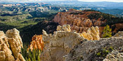
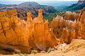 Larger
 #6050 Overview From Sunrise Point (Apr 30, 2012), Bryce Canyon National Park, Escalante, UT, 3
 Larger
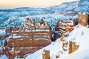
 #2013 Bryce Canyon on a Winter Morning (Mar 15, 2010), Bryce Canyon National Park, Escalante, UT, 4
 Larger
 #6519 Sunrise at Sunrise Point (Sep 27, 2013), Bryce Canyon National Park, Escalante, UT, 3
 Larger
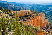
 #6520 Morning View from Farview Point (Sep 27, 2013), Bryce Canyon National Park, Escalante, UT, 3
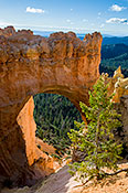
 Larger
 #6521 Natural Bridge in Bryce Canyon (Sep 27, 2013), Bryce Canyon National Park, Escalante, UT, 3
 Larger
 #6522 Bryce Canyon Rainbow Point Panorama (Sep 27, 2013), Bryce Canyon National Park, Escalante, UT, 3
 Larger
 #7798 Escalante Basin along UT 12 (Sep 27, 2013), Dixie National Forest Along UT 12, Escalante, UT, 3
 Larger
 #3059 Ancient Streambed (Apr 20, 2004), Along I-70, Green River, UT, 2
#3060 San Rafael Swell Overlook (Apr 20, 2004), Along I-70, Green River, UT, 2
#3061 Spotted Wolf Canyon Overlook (Apr 20, 2004), Along I-70, Green River, UT, 2
 Larger
 #3057 Twisted Cedars on Plateau Overlooking San Rafael Swell (Apr 20, 2004), Along I-70, Green River, UT, 2
#3058 Rock Formation Overlooking the San Rafael Swell (Apr 20, 2004), Along I-70, Green River, UT, 2
#6505 Aspen in Fall Color on Lava Flow (Sep 24, 2013), Dixie National Forest Along UT 143, Panguitch, UT, 4
 Larger
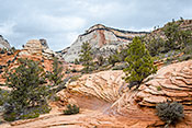
 #6049 Echo Canyon Cathedral (Apr 27, 2012), Zion NP Observation Point Trail, Springdale, UT, 3
 Larger
 #5255 Looking Across the Virgin River Valley (Mar 13, 2010), Zion NP, Springdale, UT, 4
 Larger
 #3624 Slickrock Indian Paintbrush in Slickrock Crack (Apr 22, 2005), Zion NP, Springdale, UT, 3
 Larger
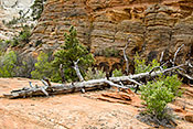
 #3626 Bleached Log on Sandstone Slick Rock (Apr 22, 2005), Zion NP East of the Tunnel, Springdale, UT, 4
 Larger
 #5267 Sandstone Formation on a Snowy Morning (Mar 14, 2010), Zion NP East of the Tunnel, Springdale, UT, 2
 Larger
 #6048 Slot in Echo Canyon (Apr 27, 2012), Zion NP Observation Point Trail, Springdale, UT, 3
 Larger
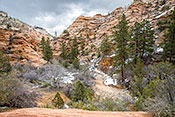
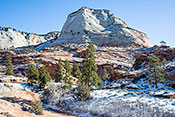
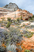
 #6033 Checkerboard Mesa Abstract (Apr 24, 2012), Zion NP East of the Tunnel, Springdale, UT, 4
 Larger
 #5266 High Country Wash (Mar 13, 2010), Zion NP East of the Tunnel, Springdale, UT, 4
 Larger
 #5268 Layered Sandstone Mountain with Foreground Wash (Mar 14, 2010), Zion NP East of the Tunnel, Springdale, UT, 4
 Larger
 #5256 Blue-gray Limestone Exposed by Landslide (Mar 13, 2010), Zion NP, Springdale, UT, 2
 Larger
 #1829 Slot Along the Emerald Pools Trail (Apr 19, 2005), Zion NP, Springdale, UT, 2
 Larger
 #5263 Vegetation on Slickrock (Mar 13, 2010), Zion NP East of the Tunnel, Springdale, UT, 4
 Larger
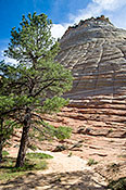
 #6032 Checkerboard Mesa and Ponderosa Pine (Apr 24, 2012), Zion NP East of the Tunnel, Springdale, UT, 4
 Larger
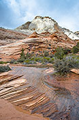
 #5262 Wet Slickrock Sandstone (Mar 13, 2010), Zion NP East of the Tunnel, Springdale, UT, 4
 Larger
 #5261 Scalloped Sandstone Landscape (Mar 13, 2010), Zion NP East of the Tunnel, Springdale, UT, 4
 Larger
 #5260 Colorful Pool Along the River Trail (Apr 24, 2012), Zion NP, Springdale, UT, 4
 Larger
 #2057 Echos in Stone (Apr 27, 2012), Zion NP Observation Point Trail, Springdale, UT, 3
 Larger
 #2642 Scene at Capitol Reef Visitor Center (Dec 19, 2002), Capitol Reef NP UT 24 and Scenic Drive, Torrey, UT, 2
#1835 Capitol Reef (Dec 12, 1997), Capitol Reef NP UT 24 and Scenic Drive, Torrey, UT, 2
#6542 Driving up the Monocline 6. Looking Down on the Waterpocket Fold (Sep 29, 2013), Capitol Reef NP Notom and Burr Trail Roads, Torrey, UT, 4
 Larger
 #6531 Faces in the Grand Wash Wall (Sep 29, 2013), Capitol Reef NP UT 24 and Scenic Drive, Torrey, UT, 4
 Larger
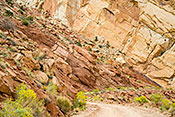
 #6530 Eroded Sandstone Wall in the Grand Wash (Sep 29, 2013), Capitol Reef NP UT 24 and Scenic Drive, Torrey, UT, 4
 Larger
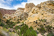
 #6524 The Fluted Wall and Other Sandstone Formations (Sep 28, 2013), Capitol Reef NP UT 24 and Scenic Drive, Torrey, UT, 4
 Larger
 #6534 Golden Throne Above a Desert Wash (Sep 29, 2013), Capitol Reef NP UT 24 and Scenic Drive, Torrey, UT, 4
 Larger
 #6539 Driving up the Monocline 3. Looking Back (Sep 29, 2013), Capitol Reef NP Notom and Burr Trail Roads, Torrey, UT, 4
 Larger
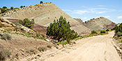
 #6538 Driving up the Monocline 2. First View of Monocline (Sep 29, 2013), Capitol Reef NP Notom and Burr Trail Roads, Torrey, UT, 4
 Larger
 #6540 Driving up the Monocline 4. A Tilted World (Sep 29, 2013), Capitol Reef NP Notom and Burr Trail Roads, Torrey, UT, 4
 Larger
 #6536 Morrison Clay and Mudstone Formations (Sep 29, 2013), Capitol Reef NP Notom and Burr Trail Roads, Torrey, UT, 4
 Larger
 #3219 Outcrop Across Smuggler's Notch from the Trail (Oct 01, 2004), Smuggler's Notch State Park, Stowe, VT, 2
 Larger
 #504 Colorful Volcanic Rock on Mt. Rainier South Face (Jul 31, 2014), Mt. Rainier National Park Paradise Area, Ashford, WA, 3
 Larger
 #6830 Wilson Glacier Details (Jul 31, 2014), Mt. Rainier National Park Paradise Area, Ashford, WA, 4
 Larger
 #6311 Tree Molds Along the Trail of Two Forests (Aug 12, 2013), Mt. St. Helens National Volcanic Monument South, Carson, WA, 3
 Larger
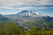
 #4854 A Close Look at Mount St. Helens (May 27, 2009), Mt. St. Helens National Volcanic Monument West, Castle Rock, WA, 3
 Larger
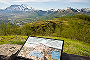
 #4852 Sign -- Volcanoes Create Long-term Problems (May 27, 2009), Mt. St. Helens National Volcanic Monument West, Castle Rock, WA, 3
 Larger
 #4853 Toutle River Cuts New Course (May 27, 2009), Mt. St. Helens National Volcanic Monument West, Castle Rock, WA, 3
 Larger
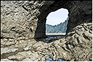
 #4876 Hole-in-the-Wall at Rialto Beach (May 30, 2009), Olympic National Park -- Mora and Rialto Beach, Forks, WA, 2
 Larger
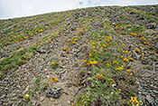
 #6771 Scree Slope with Stripes of Vegetation (Jul 25, 2014), Olympic National Park -- Lillian Ridge Trail, Port Angeles, WA, 3
 Larger
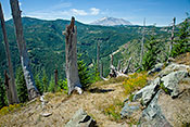
 #6316 View from Bear Meadow (Aug 13, 2013), Mt. St. Helens National Volcanic Monument North, Randle, WA, 4
 Larger
 #4373 Glen Walls (Aug 06, 2007), Parfrey's Glen SNA, Baraboo, WI, 3
 Larger
 #4368 Boardwalk through the Glen (Aug 06, 2007), Parfrey's Glen SNA, Baraboo, WI, 2
 Larger
 #4369 Ice Age Ruble in the Glen (Aug 06, 2007), Parfrey's Glen SNA, Baraboo, WI, 3
 Larger
 #4370 Stream Entrance (Aug 06, 2007), Parfrey's Glen SNA, Baraboo, WI, 2
 Larger
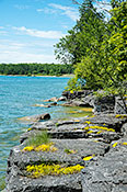
 #2825 Rocky Lake Michigan Shore (Jun 23, 2016), Newport State Park, Ellison Bay, WI, 3
 Larger
 #2407 Pools on the Cave Point Rocky Beach (Jul 18, 2003), Cave Point Door County Park, Jacksonport, WI, 2
 Larger
 #2403 Cave Point Showing Undermined Shoreline (Jul 18, 2003), Cave Point Door County Park, Jacksonport, WI, 2
#5719 The Bad River through Devil's Gate (Oct 16, 2018), Copper Falls State Park, Mellen, WI, 3
 Larger
 #5347 Red Granite Falls Looking Downstream (Oct 12, 2016), Copper Falls State Park, Mellen, WI, 3
 Larger
 #916 Multicolored Sand in Picture Rock Cave (Oct 20, 2014), Wyalusing SP, Prairie Du Chien, WI, 3
 Larger
 #889 Picture Rock Cave (Oct 20, 2014), Wyalusing SP, Prairie Du Chien, WI, 3
 Larger
 #2303 The Hogsback Overview (Sep 15, 2002), Hogsback, Steuben, WI, 2
 Larger
 #6164 Yellowstone Canyon from Artists Point (May 15, 2012), Yellowstone Grand Canyon, Canyon Village, WY, 3
 Larger
 #6174 Descending to Red Rock #7: View from the Deck (May 17, 2012), Yellowstone Grand Canyon, Canyon Village, WY, 3
 Larger
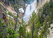
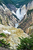
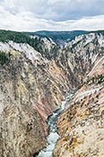
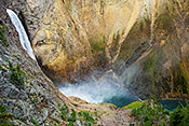
 #6163 Lower Yellowstone River Falls from Artists Point (May 15, 2012), Yellowstone Grand Canyon, Canyon Village, WY, 3
 Larger
 #6449 Descending Uncle Tom's Trail 2. On a Landing (Sep 14, 2013), Yellowstone Grand Canyon, Canyon Village, WY, 3
 Larger
 #6176 Yellowstone Canyon from Inspiration Point (May 17, 2012), Yellowstone Grand Canyon, Canyon Village, WY, 3
 Larger
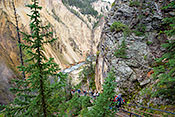
 #6451 Descending Uncle Tom's Trail 4. Looking Down River (Sep 14, 2013), Yellowstone Grand Canyon, Canyon Village, WY, 3
 Larger
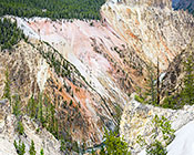
 #6171 Descending to Red Rock #4: Colorful Wall (May 17, 2012), Yellowstone Grand Canyon, Canyon Village, WY, 3
 Larger
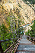
 #6450 Descending Uncle Tom's Trail 3. Looking into the Canyon (Sep 14, 2013), Yellowstone Grand Canyon, Canyon Village, WY, 3
 Larger
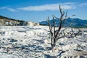
 #6156 Inactive Terrace at Mammoth Hot Springs (May 14, 2012), Yellowstone US 89 Mammoth to Madison Junction, Mammoth, WY, 3
 Larger
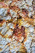
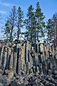
 #6118 Basalt Columns at Sheepeater Cliff (May 16, 2012), Yellowstone US 89 Mammoth to Madison Junction, Mammoth, WY, 3
 Larger
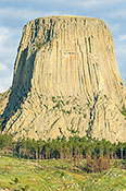
 #6297 Devil's Tower Close-up (Aug 06, 2013), Devils Tower National Monument, Sundance, WY, 3
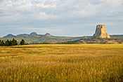
 Larger
 #6296 Devils Tower in Context (Aug 06, 2013), Devils Tower National Monument, Sundance, WY, 3
 Larger