All images within this web site are copyrighted original works by David Schwaegler.


All images within this web site are copyrighted original works by David Schwaegler.
 |
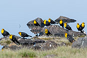
Fauna (26 images) |
|---|---|
 |
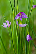
Flora (127 images) |
 |
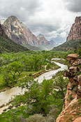
Landscape and Miscellaneous (174 images) |
| United States Wheat Fields | , | From the northern plains of North Dakota west to eastern Washington |
| Colorado National Monument | Fruita, CO | From I-70 exit onto CO 340 south to the park entrance |
| Devil's Canyon (BLM) | Fruita, CO | Adjacent to Colorado National Monument. From CO 340 turn west into Kings View Estate subdivision then .5 miles to trailhead. |
| Great Sand Dunes National Park | Blanca, CO | At northern end of CO 150 |
| Blacks Creek Road | Boise, ID | Exit 64 off I84 then head east and look for the Blacks Creek Road sign. |
| Camas Prairie Centennial Marsh | Hill City, ID | I-84 Exit #95; US 20 NE for 45 mi to Hill City; watch for WMA sign; R (S) onto Swamp Rd; go ~4 mi to T intersection (Stokes Rd); L (E) and go until rd curves N; L on rough road into center of marsh; |
| City of Rocks National Reserve | Almo, ID | From I-84 near Burley take ID 77 south about 20 miles, then Elba-Almo road south to the visitor center in Almo. |
| Hells Canyon NRA Along ID 71 | Cambridge, ID | In Cambridge at the junction of US 95 head west on ID 71 into the Hell's Canyon |
| Hells Canyon NRA Seven Devils Recreation Site | Riggins, ID | Take Seven Devils Road less than a mile south of Riggins off US 95 all the way to the end (about 18 miles). |
| Mores Mountain in Shafer Butte Recreation Area | Boise, ID | From Boise, drive up Bogus Basin Road 16 miles to the Bogus Basin ski area. Keep going through the parking lot to the Frontier Point Recreation Center. Follow signs to the Shafer Butte picnic area campground for the Mores Mtn trailhead. |
| Mountain Home Reservoir | Mountain Home, ID | I-84 Exit #95, N on ID 20 for 0.75 mi; L (W) on NE Reservoir Rd at "Sportsmanís Access" sign |
| Mt. Harrison Research Natural Area | Albion, ID | From Albion go south on ID 77 about five miles to Howell Canyon Road that will take you up to Mt. Harrison. |
| Payette NF, Bear Basin | McCall, ID | Go north from McCall on 55, turn right on Brundage Mtn Road, turn right on FR 452, then right on FR 451 back to 55. Flowers are along both forest roads. |
| Payette NF, Scabland Sagebrush Site | Council, ID | From Council take the Council Cuprum Road about 16 miles to forest road 004. There are several interesting meadows along 004. |
| Payette River Along Banks Lowman Highway | Banks, ID | From Boise head north on ID 55 about 40 miles to the Banks Lowman Highway. |
| Shoshone Falls Park | Twin Falls, ID | From US 93 in Twin Falls take Pole Line Rd east to south on Eastland Dr to Falls Avenue east. Signs give directions to the park. |
| Snake River Birds of Prey Conservation Area | Kuna, ID | I-84 Exit #44; S on Meridian Rd (ID 69) for 8 mi; right on Kuna then left on Swan Falls Road. |
| US 95 Near Midvale Hill | Midvale, ID | Along an unnamed road west from US 95 at 44 26.086 N, 116 48.961 W |
| Glacier National Park Avalanche Creek Trail | West Glacier, MT | From the Apgar area go about 15 miles north on the Going to the Sun Road to the well marked trail head. |
| Glacier National Park Going to the Sun | West Glacier, MT | In West Glacier the entrance to the park is clearly marked off US 2. |
| Glacier National Park Iceberg Lake Trail | Babb, MT | From Babb on US 89 go west on the Many Glaciers Road to the Swift Current Lodge. The trailhead is at the end of the parking lot. |
| Glacier National Park Lake McDonald Lake | West Glacier, MT | In West Glacier the entrance to the park is clearly marked off US 2. |
| Glacier National Park North Fork Roads | West Glacier, MT | These roads lead north from the Apgar area. Outside road is mostly paved and Inside Road is gravel. |
| Glacier National Park St. Mary Falls Trail | St. Mary, MT | From St. Mary on US 89 go west on the Going to the Sun Road about 10 miles to the trailhead. |
| Kootenai Falls | Troy, MT | Along US 2 between Troy and Libby MT |
| Great Basin National Park | Baker, NV | Baker is on NV 487 south of US 6. From Baker take NV 488 into the park. |
| Bryce Canyon National Park | Escalante, UT | Just north of UT 12 about 15 miles east of the junction of US 89 and UT 12 |
| Capitol Reef NP Notom and Burr Trail Roads | Torrey, UT | Notom Bullfrog Road goes south from UT 24 near the east side national park orientation pullout. |
| Capitol Reef NP UT 24 and Scenic Drive | Torrey, UT | Along UT 24 |
| Cedar Breaks National Monument | Cedar City, UT | Along UT 148 |
| Dixie National Forest Along UT 12 | Escalante, UT | From US 89 near Panguich to UT 20 near Torrey, UT 12 passes through or near to Bryce Canyon, the Escalante National Monument, and the Dixie National Forest. |
| Dixie National Forest Along UT 143 | Panguitch, UT | From the junction of US 89 and UT 143 in Panguitch to the junction with I15 near Parowan |
| Logan Canyon | Logan, UT | Along US 89 from Bear Lake to Logan |
| Wasatch-Cache NF -- Monte Cristo Scenic Drive | Ogden, UT | From Ogden take UT 39 (Ogden Canyon Rd.) into the high country. The campground and surrounding alpine meadows at 9000 feet bloom in mid-to late July. |
| Wasatch-Cache NF -- Tony Grove | Garden City, UT | From Garden City go about 18 miles west on US 89 to Tony Grove Road |
| Zion NP | Springdale, UT | UT 9 |
| Zion NP East of the Tunnel | Springdale, UT | UT 9 |
| Zion NP Observation Point Trail | Springdale, UT | UT 9 |
| Devils Tower National Monument | Sundance, WY | Go west on US 14 to Carlile Junction then north (right) to the park. |
| Medicine Bow National Forest Snowy Mountains | Laramie, WY | Go west from Laramie along WY 130. |