All images within this web site are copyrighted original works by David Schwaegler.


All images within this web site are copyrighted original works by David Schwaegler.
 |
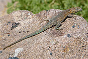
Fauna (6 images) |
|---|---|
 |
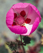
Flora (42 images) |
 |
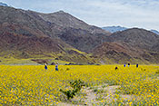
Landscape and Miscellaneous (37 images) |
| Death Valley NP | Furnace Creek, CA | CA 190 to Badwater Road |
| Death Valley NP Cottonwood and Marble Canyons | Stovepipe Wells, CA | CA 178/190 |
| Death Valley NP Panamint Mountains | Panamint Springs, CA | Inyo County |
| Death Valley NP Titus Canyon (Amagorsa Mtns.) | Inyo County, CA | Go Northeast on NV 374, turn left on Titus Canyon Road |
| Joshua Tree National Park | Twentynine Palms, CA | 25 miles east of Indio on I-10 exit north onto Cottonwood Spring Road |
| Mojave National Preserve | Baker, CA | Includes 1.5 million acres. Access along I-40 to the south and I-15 to the north just west of the Nevada state line. |
| Ash Meadows NWR | Pahrump, NV | East of NV 373 about 2 miles north of the CA, NV border. |
| Christmas Tree Pass | Laughlin, NV | The pass road connects US 95 and NV 163 approximately six miles west of Laughlin on NV 163. |
| Mount Charleston | Las Vegas, NV | From Las Vegas take 95 north then156 west |
| Red Rock Canyon National Conservation Area | Las Vegas, NV | Located 17 miles west of the Las Vegas Strip. Take 159 (Charleston Boulevard) west to the entrance. From the south exit I-15 onto 160 west to 159 then follow 159 to entrance. |