All images within this web site are copyrighted original works by David Schwaegler.


All images within this web site are copyrighted original works by David Schwaegler.
 |
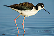
Fauna (23 images) |
|---|---|
 |
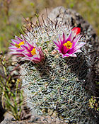
Flora (63 images) |
 |
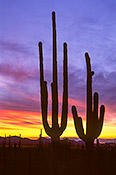
Landscape and Miscellaneous (59 images) |
| Apache Trail (AZ 88) | Apache Junction, AZ | The Apache Trail Highway goes from Apache Junction to a series of resoivors (Canyon, Apache, and Roosevelt) then to Globe. |
| Boyce Thompson Arboretum State Park | Superior, AZ | West of Superior on US 60. |
| Desert Botanical Garden | Phoenix, AZ | 1201 N Galvin Pkwy in the Papago Park |
| Gilbert Water Ranch | Gilbert, AZ | On E Guadalupe Rd just east of S. Greenfield Rd. adjacent to the Gilbert Public Library |
| Kofa National Wildlife Refuge | Quartzsite, AZ | There are several entrances to the east as you go south on US 95 starting about 15 miles south of Quartzsite. |
| Lost Dutchman State Park | Apache Junction, AZ | Go north on AZ 88 (N Apache Trail) to the park on the right. |
| Organ Pipe Cactus National Monument | Ajo, AZ | South on AZ 85 from Gila Bend past Ajo almost to the Mexican border |
| Saddle Mountain | Tonopah, AZ | Exit I-10 at Tonopah (94) and drive south on 411th Avenue to the Salome. Right on Salome to the mountain. |
| Saguaro National Park | Tucson, AZ | Just east of Tucson entrance is near Old Spanish Trail and Escalante; Northwest of town on Kinney Rd. |
| Tonto NF Hieroglyphics Canyon Trail | Gold Canyon, AZ | Go east on US 60 then north on Kings Ranch Road, east on Baseline, north on Mohican, west on Valley View (becomes Whitetail), east on Cloudview to parking lot. |
| Tonto NF Superstition Wilderness Area | Apache Junction, AZ | Go east on US 60 then north on Peralta Road. Drive seven miles on the dirt road to the parking lot at the trailhead. |
| Usery Regional Park | Mesa, AZ | Go east on McKillips to Usery Pass Road, then north (left) to the park entrance. |
| White Tank Mountain Regional Park | Phoenix, AZ | I-10 west to AZ 303 north to Olive, then west 4 miles to the park. |