All images within this web site are copyrighted original works by David Schwaegler.


All images within this web site are copyrighted original works by David Schwaegler.
 |
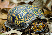
Fauna (14 images) |
|---|---|
 |
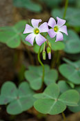
Flora (103 images) |
 |
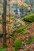
Landscape and Miscellaneous (101 images) |
| Blanchard Springs Caverns | Fifty-six, AR | North of AR 14 east of the town of Fify-six. |
| Buffalo National River -- Buffalo Point | Harriet, AR | From the junction of AR 27 and AR 14 (Harriet) go north 7 miles |
| Buffalo National River -- Lost Valley | Ponca, AR | From the junction of AR 74 and AR 43 near Ponca go south 1 mile on AR 43 |
| Buffalo National River -- Tyler Bend | St. Joe, AR | Go south four miles from St. Joe on US 65 |
| Calico Rock | Calico Rock, AR | Intersection of AR 5, AR 56 and the White River |
| Cossatot River State Park Natural Area | Wickes, AR | Visitor center s on U.S. 278 east of Wickes where the highway crosses the Cossatot. |
| Devil's Knob Area | Melbourne, AR | Travel north on State Highway 9 from Mountain View approximately 15 miles. Turn left on Mt. Olive Access Road and travel 1.3 miles to natural area sign. |
| Grandview Prairie | Columbus, AR | North from Columbus on CR 35. |
| Ouachita National Forest Caney Creek Wilderness | Langley, AR | For the eastern trailheads go north 5 miles to the Albert Pike NRA, then take the forest road (106) west past Bard Springs |
| Ouachita National Forest Little Missouri River | Langley, AR | Go north 5 miles from Langley on AR 369 to the Albert Pike recreation area and follow the signs to the falls. |
| Ouachita NF, Albert Pike Winding Stairs Trail | Langley, AR | Go north 5 miles from Langley on AR 369 to the Albert Pike recreation area. At the southern end of the area take the forest road across the Little Missouri about 2 miles west to the signed trail head. Be prepared to wade. |
| Ozark National Forest -- Falling Water Creek | Ben Hur, AR | From Ben Hur go south on AR 16 to forest road 1205. Turn left (east) at fork keep left and follow the creek. |
| Ozark National Forest -- Pedestal Rock Trail | Dover, AR | Go north on AR 7 to AR 16 then east to signed turn off. |
| Petit Jean State Park | Morrilton, AR | Along AR 154 just west of the Arkansas River. |
| Cache River State Natural Area | Vienna, IL | South of Vienna on US 45. |
| Devil's Kitchen Lake | Carbondale, IL | Go south on Giant City Road to Grassy Road, then east to Tacoma Lake Road, then south along the east shore of the lake. |
| Ferne Clyffe State Park | Goreville, IL | Exit I-57 on IL 148, then south on US 37 past Goreville |
| Giant City State Park | Carbondale, IL | From Carbondale go south on US 51 to CR 29 (Makanda Rd) east into the park. |
| Lusk Creek Canyon Nature Preserve | Eddyville, IL | East on CR 5, then north on Indian Kitchen Road to parking area. Trailhead across road from parking. 1.2 mile hike to canyon. |
| Shawnee NF -- Bell Smith Springs | Eddyville, IL | Go north on IL 145 to any of several well signed roads leading west. |
| Shawnee NF -- Burden Falls Wilderness | Harrisburg, IL | Go south from Harrisburg on IL 145. At Delwood (don't blink), turn east on McCormick Road to wilderness signs. |
| Shawnee NF -- Garden of the Gods | Mitchellsville, IL | South on IL 34, east on Karbers Ridge, north on CR 10 (Garden of the Gods Road) |
| Shawnee NF -- La Rue Pine Hills | Jonesboro, IL | Adjacent to La Rue Pine Hills. From Jonesboro go west on IL 146 to IL 3, then north to Wolf Lake and east on State Forest Rd then north on Pine Hills Rd. |
| Shawnee NF -- Rim Rock Trail | Elizabethtown, IL | From Mitchellsville South on IL 34, east on Karbers Ridge, watch for signs for Rim Rock. |
| World Shooting Complex | Sparta, IL | Go north from Sparta on IL 4 and watch for sign |
| Johnson's Shut-Ins State Park | Graniteville, MO | From MO 21 in Graniteville, turn west onto SSR N and follow it about 13 miles to the park entrance. |
| Mulberry Creek Wildlife Refuge | Amoret, MO | |
| Taum Sauk Mountain State Park | Ironton, MO | South on MO 21, then right on SSR CC to the park entrance. |